17 Best Easy Hikes in Washington State (According to a Local)
One of my favorite parts of living in Washington is the abundance of easy yet stunning hikes.
There are so many trails that lead to gorgeous lakes, mountains, waterfalls, and beaches with little effort.
I’ve lived in Washington for years and hiked many of the state’s awesome trails. In this list I’m sharing the best easy hikes in Washington.
What makes these hikes the best?
- They have some of the most beautiful views in Washington for relatively little effort.
- They’re actually easy to moderate (since people have varying definitions of “easy” hikes). While other lists of beginner-friendly hikes include some pretty lengthy trails, I’ve only included hikes between 1.5 and 5.5 miles with most in the 2 to 4 mile range. I find this range to be easy but just challenging enough to be worth driving to and doing.
- They are easy to access on roads that can be navigated in any vehicle. I’ve noted which trails are on rougher roads but none should be so rough to prevent standard cars from accessing these trails.
No matter your hiking abilities, all of these easy trails should be on your list of bucket list hikes in Washington.
Here are the 17 best easy hikes in Washington.
Know Before You Go
- Most hikes in Washington require one of three passes to park at the trailhead, depending on where the trail is located (national park, national forest, or state park). Once you’ve chosen your hike, check out the Washington Trails Association (WTA) website for pass descriptions and information on where to purchase them. You can see which pass is needed for each hike on the trail’s WTA page.
- It’s no secret that these are some of the best hikes in Washington. Most of these hikes are very popular… to the point that they may be so crowded on weekends you’d rather do a hard hike. Go very early in the morning (especially if you are planning to go on a sunny weekend in the summer) or at another odd day or time.
- Check the trail’s WTA page for recent trip reports to make sure trail conditions are good.
- New to hiking? Here’s what I bring on every hike.
- Learn the leave no trace seven principles to avoid harming the local ecosystem and fellow visitors during your hike.
Best Easy Hikes with Mountain Views
Naches Peak Loop
- Distance: 3.5 miles
- Elevation gain: 500 feet
- Location: Mount Rainier National Park
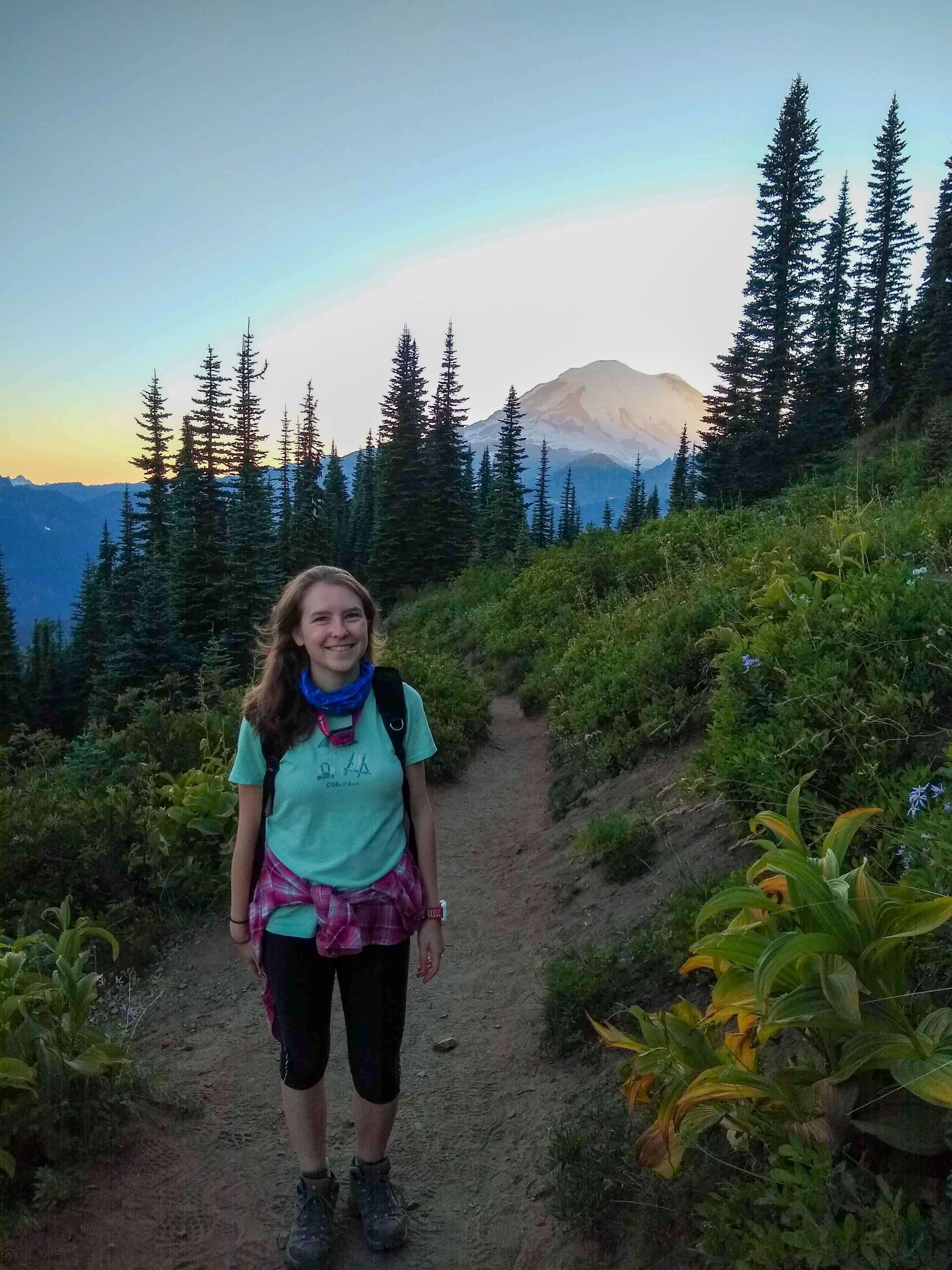
Naches Peak Loop is one of the best easy hikes because you don’t have to wait until the end of the hike to enjoy a beautiful viewpoint. Instead, there are breathtaking views throughout the entire hike.
Located on the eastern side of Mount Rainier National Park, the Naches Peak Loop guides you to amazing views of Mount Rainier and meadows of wildflowers. It’s recommended that you take the loop in the clockwise direction for the best views of Mount Rainier.
The loop is made up of two trails that surround Naches Peak: The Pacific Crest Trail to the north of the Peak and the Naches Peak trail along the south side. Keep this in mind because you will need to pay attention to signage to know when it’s time to switch between the two trails.
Related: Best Easy Day Hikes in Mount Rainier National Park
Dege Peak
- Distance: 4 miles
- Elevation gain: 600 feet
- Location: Mount Rainier National Park

The Sourdough Ridge Trail is the starting point for several awesome trails in the Sunrise area of Mount Rainier National Park. I recommend taking it to Dege Peak for one of the easiest hikes in the area.
Hiking to Dege Peak will take you through subalpine meadows to amazing views of Mount Rainier and other highlights of the Cascade Range including Mount Baker, Glacier Peak, and Mount Adams.
Hurricane Hill
- Distance: 3.2 miles
- Elevation gain: 650 feet
- Location: Olympic National Park
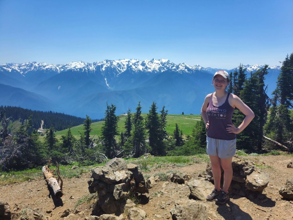
Hurricane Hill is another hike with breathtaking views not just at the top of the trail, but throughout the entire hike.
This paved trail is in the Hurricane Ridge area of Olympic National Park.
It will take you to stunning views of the Olympic Mountains. On a clear day you’ll also get a great view of Mount Baker, the San Juan Islands, and Vancouver Island over the Strait of Juan de Fuca.
I admit that this trail felt way more steep in places than I expected for the distance and elevation gain, but it is SO worth it for the views. In my opinion this is one of the most beautiful hikes I’ve ever done in Washington.
Rattlesnake Ledge
- Distance: 4 miles
- Elevation gain: 1160 feet
- Location: North Bend, WA
Rattlesnake Ledge is a classic hike near Seattle.
It’s one of the most popular trails because it’s less than an hour from Seattle and it’s a solid, easy hike that challenges you just enough for pretty views.
When I say it’s popular, I mean it’s super popular. One time I got there at 7am on a Saturday morning and we got one of the last parking spots – and it’s a huge parking lot. But, it’s must-do hike that every Washington hiker should experience at least once.
This trail will take you to 3 ledges with viewpoints. To make this hike even easier, you could just soak up the views from the lowest ledge before returning to the trailhead.
Related: 5 Must-Do Hikes In North Bend (Easy To Hard)
Best Easy Hikes to Lakes
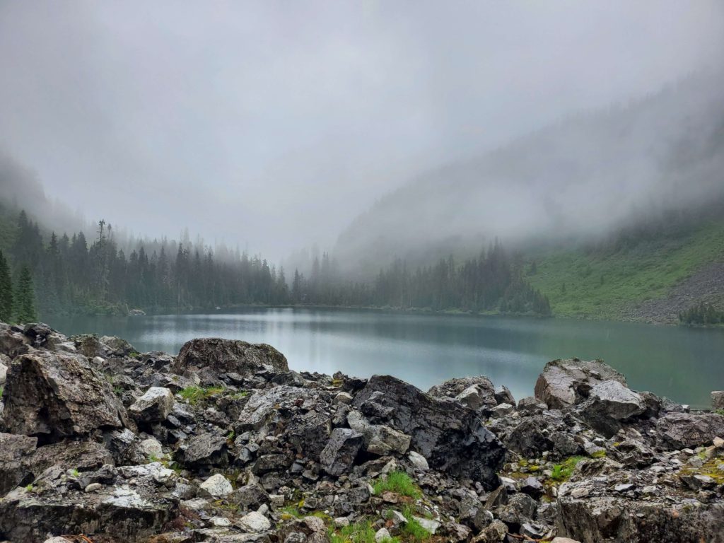
Mirror Lake
- Distance: 2.2 miles roundtrip (+0.5 mile each way to walk from lower parking area to the trailhead)
- Elevation gain: 870 feet
- Location: near Snoqualmie Pass
The trail to Mirror Lake takes hikers on an easy jaunt through the Okanogan-Wenatchee National Forest.
You’ll get the chance to see two lakes if you take a short detour to Cottonwood Lake, but Mirror Lake is the main attraction here.
This trail makes for a great easy day hike or an introductory backpacking trip since you can camp around the lake.
Note that you’ll have to drive on an unpaved forest road to get to the trailhead, but although it’s a bit rougher we made the drive just fine in a sedan.
Related: 15 Spectacular Lake Hikes Near Seattle (For All Skill Levels)
Blue Lake
- Distance: 4.4 miles
- Elevation gain: 1050 feet
- Location: Okanogan-Wenatchee National Forest
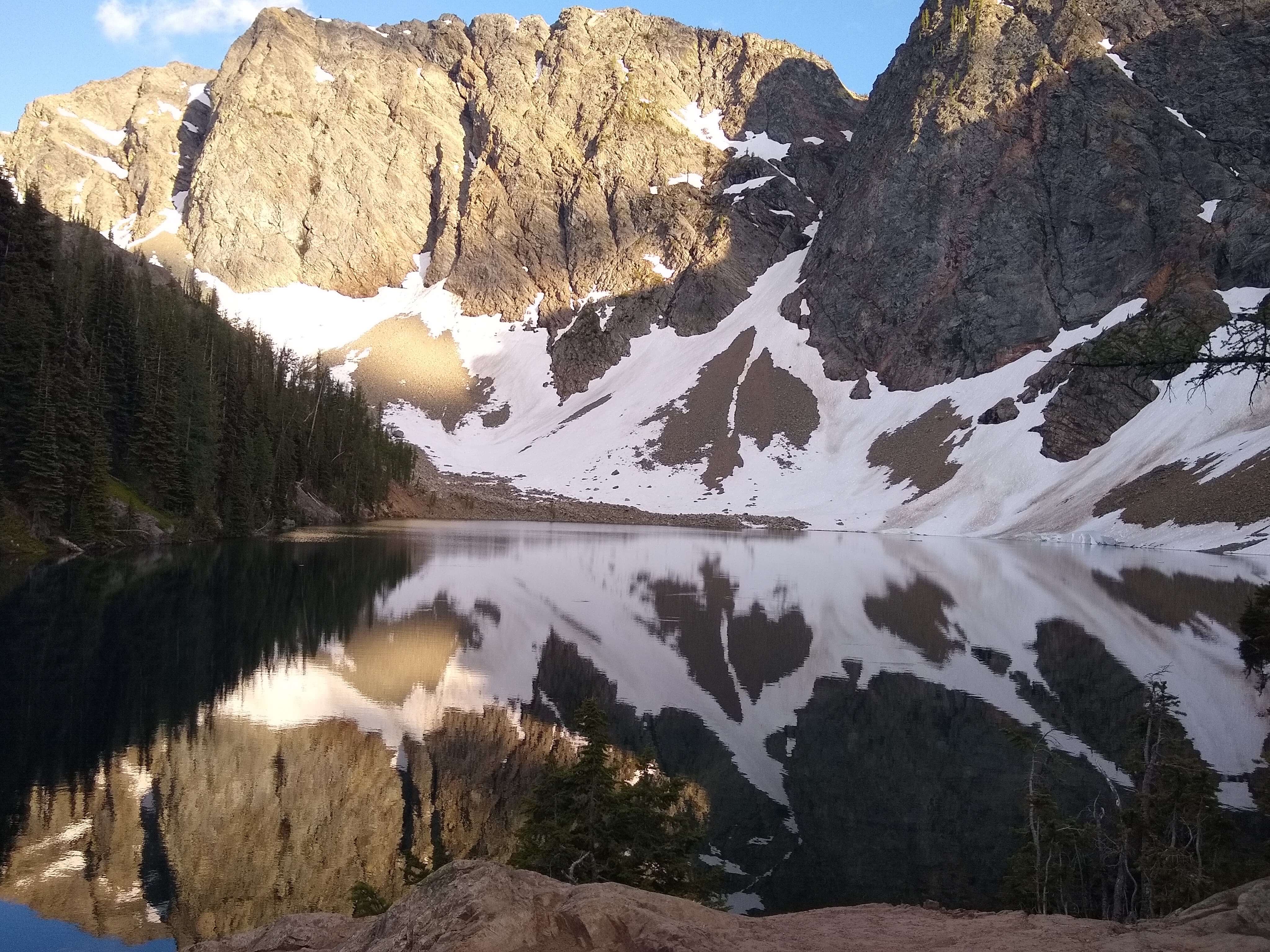
The trail to Blue Lake is along Highway 20 just outside North Cascades National Park.
This easy hike will guide you through forests and meadows up to a beautiful mountain lake. If you’re lucky you may also see a mountain goat (we did!).
Blue Lake is my favorite lake hike on this list!
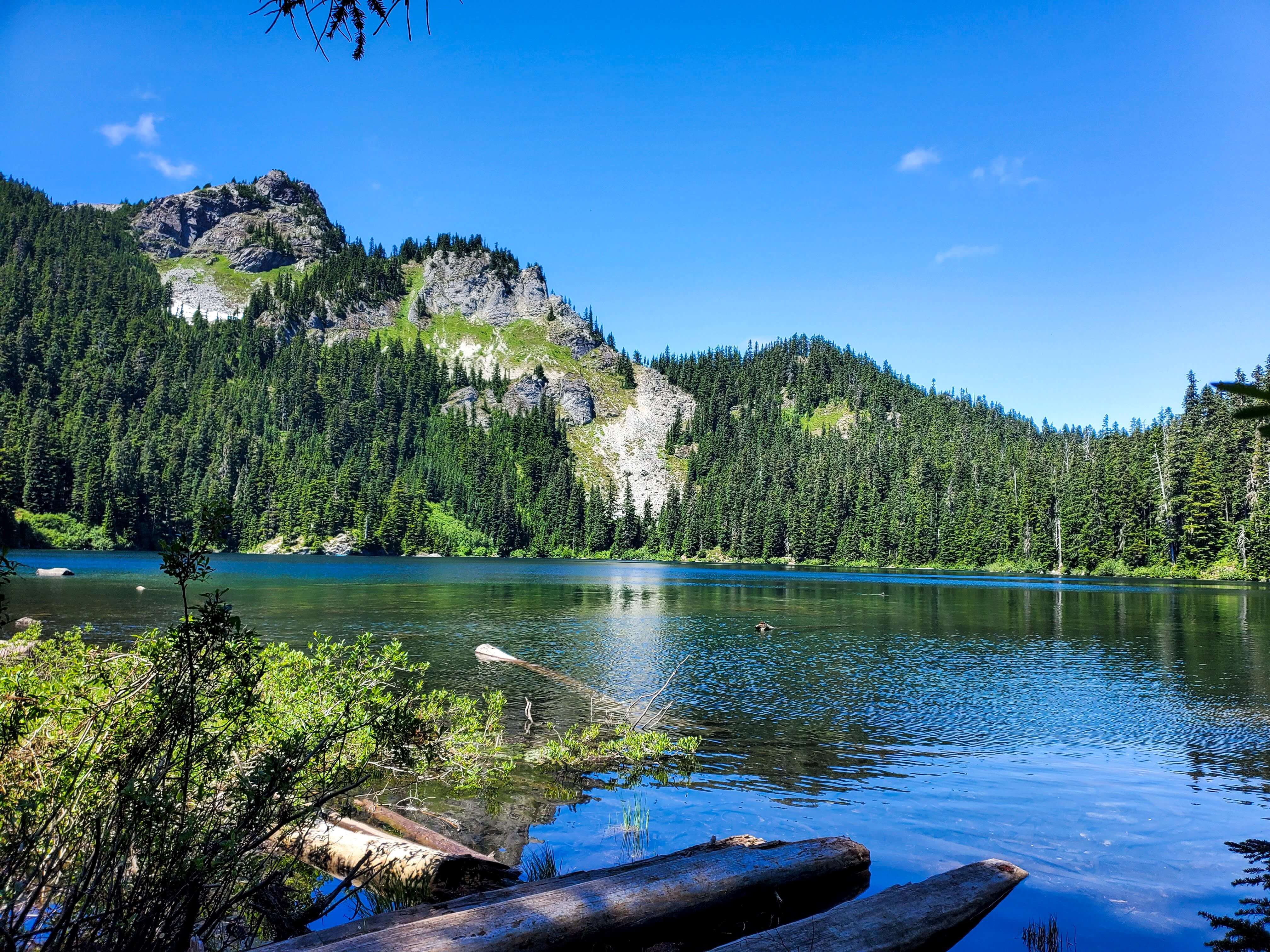
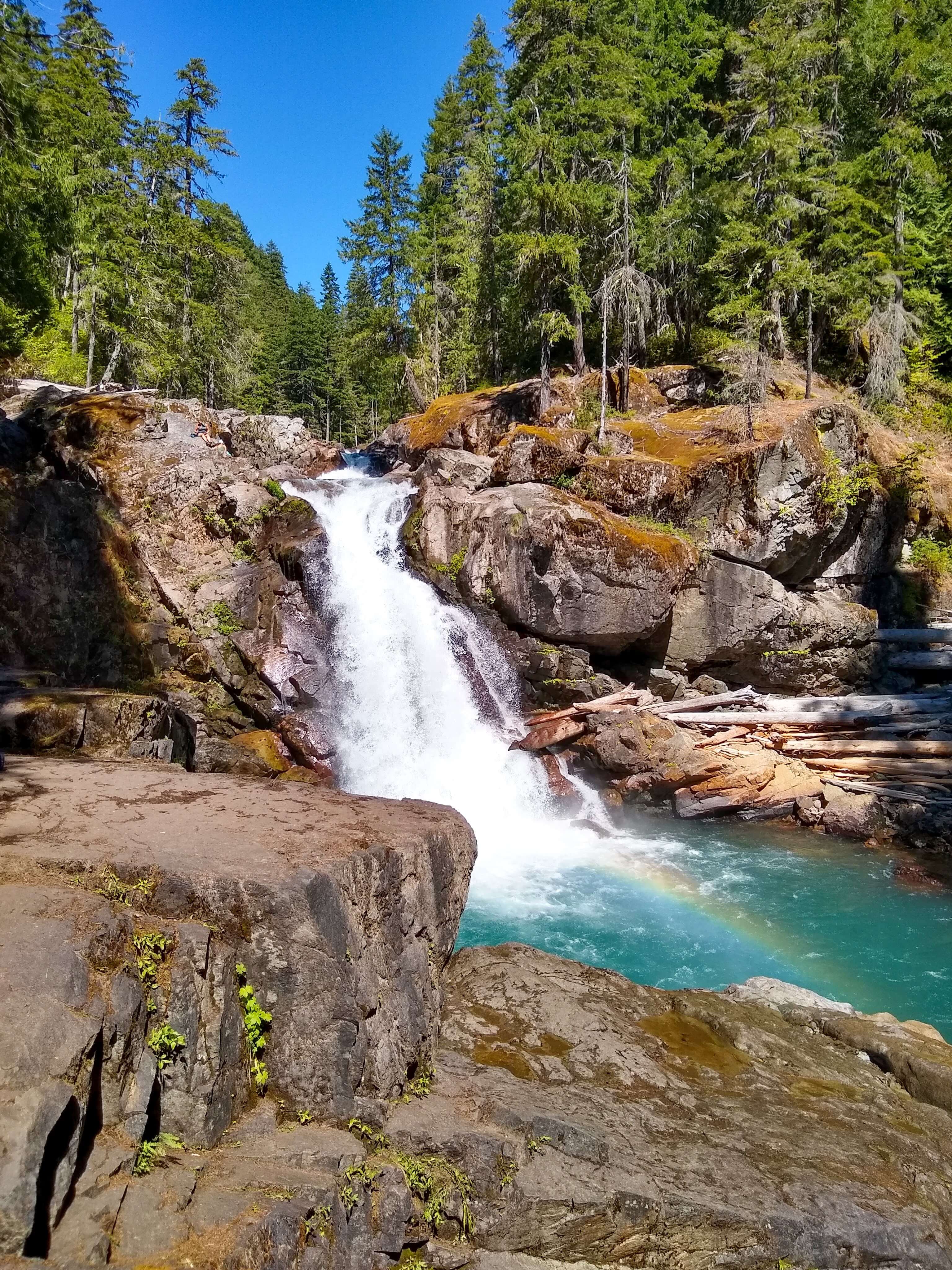
Thunder Knob
- Distance: 3.6 miles
- Elevation gain: 425 feet
- Location: North Cascades National Park
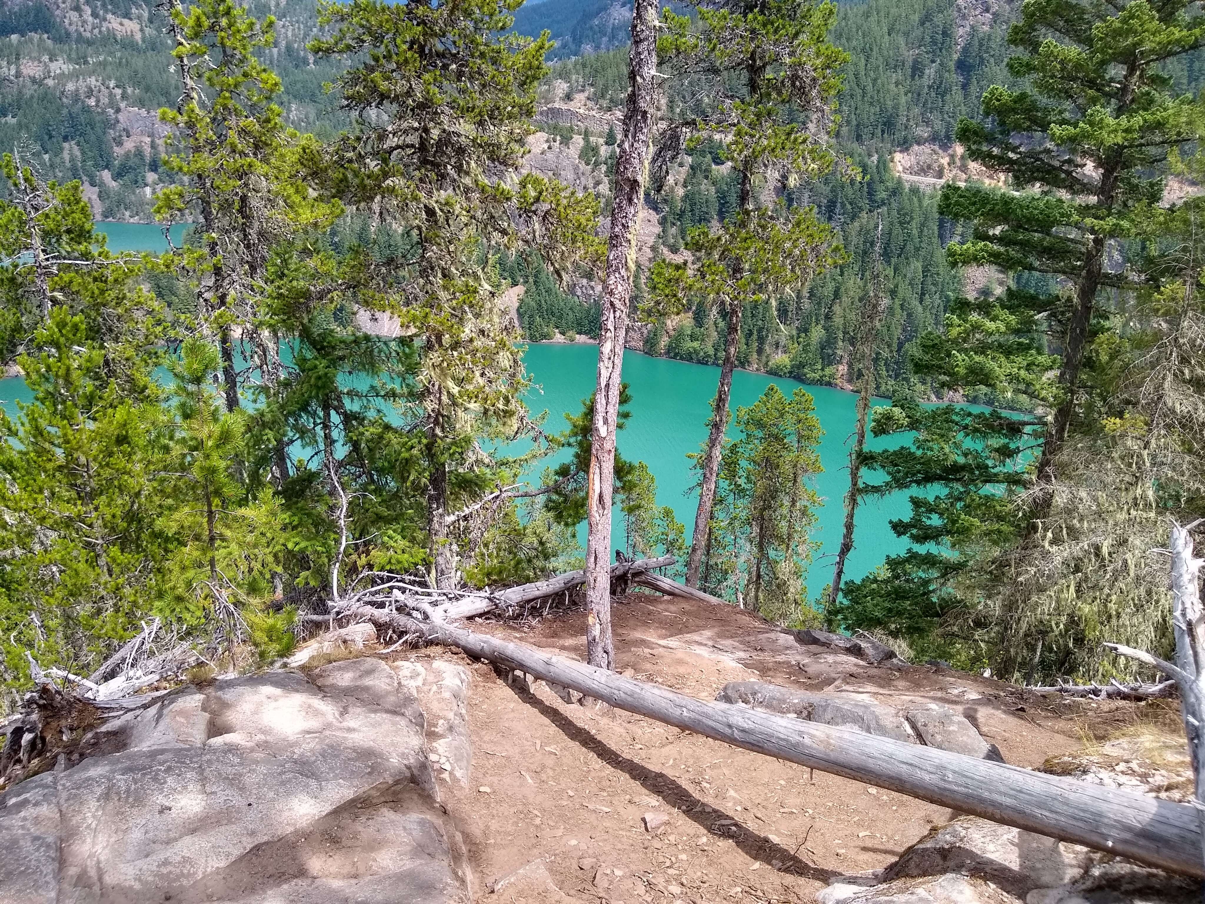
Thunder Knob is a popular, family-friendly hike in North Cascades National Park.
From Thunder Knob you’ll get pretty views of Diablo Lake’s mesmerizing turquoise water. While you don’t have to do any hiking to see Diablo Lake, it’s still worth taking this trail as it’s one of the easiest (and easiest to drive to) hikes in the park.
The Thunder Knob trailhead is along Highway 20 right outside the entrance to Colonial Creek campground.
Related: The Car Camper’s Guide to North Cascades National Park
Lake 22
- Distance: 5.4 miles
- Elevation gain: 1350 feet
- Location: Mountain Loop Highway
Lake 22 is a popular lake hike just over an hour from downtown Seattle. This hike is more moderate than easy but it’s a great option for many hikers who want just enough of a challenge without being very strenuous.
The trail to Lake 22 is rocky in some sections so make sure to wear sturdy shoes.
This is another hike that I’ve seen get incredibly busy. I hiked this trail early on a Saturday morning and when I left the lake to head back to the car around 8:30am it was already starting to get busy. By the time I returned to the trailhead there was a half an hour line for the bathroom and about 100 cars overflowing from the parking lot down the road.
Even though I’m recommending this as one of the best hikes in Washington, I admit that I don’t think it’d be worth it to hike with that many people. I strongly recommend trying this hike at an off-peak time.
Best Easy Hikes to Waterfalls
Sol Duc Falls
- Distance: 1.6 miles
- Elevation gain: 200 feet
- Location: Olympic National Park
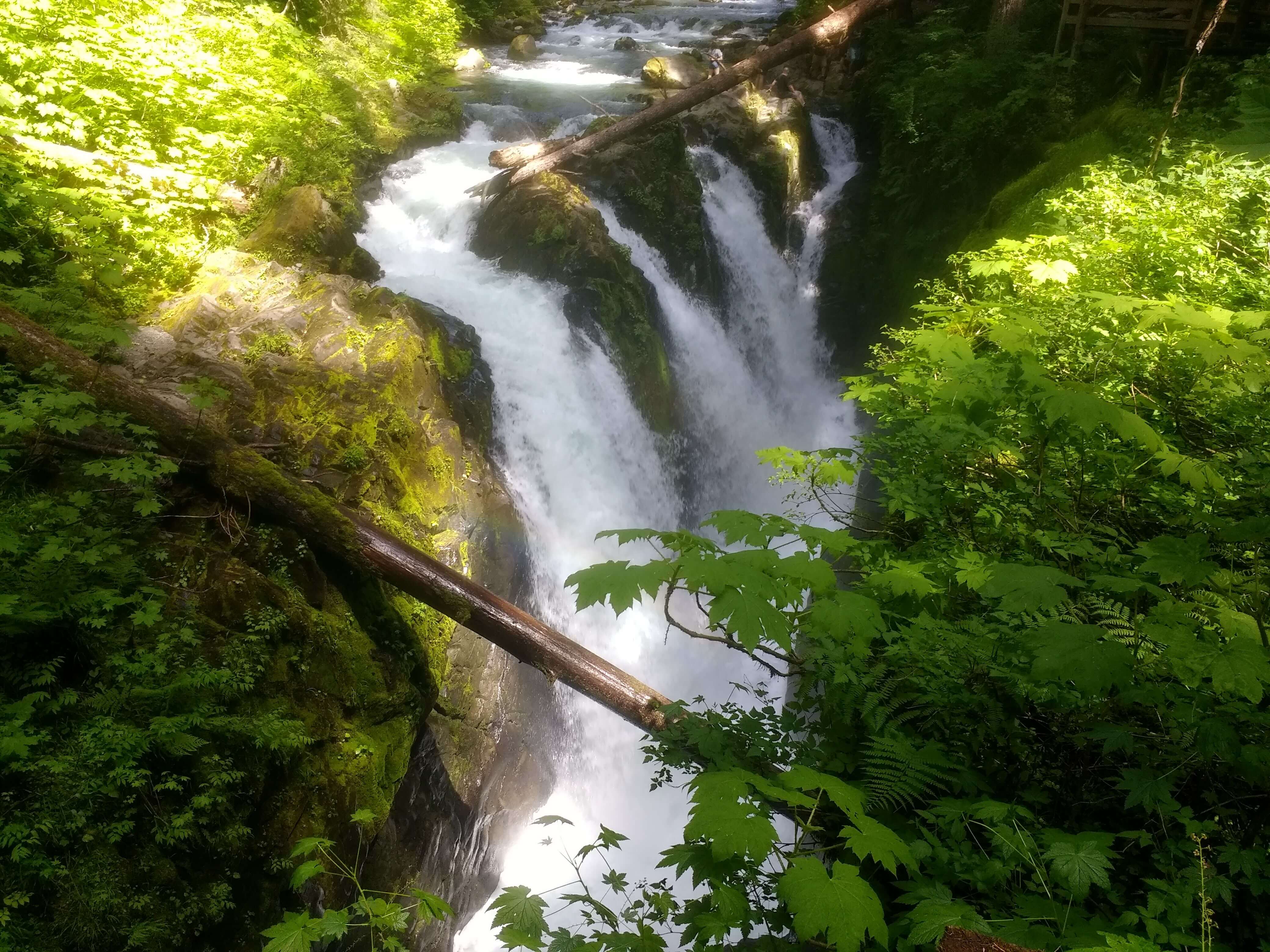
Most other hiking guides recommend the easy hike to Marymere Falls in Olympic National Park, but for a similar difficulty level I personally prefer Sol Duc Falls.
Sol Duc Falls is in the Sol Duc area of Olympic National Park.
This 48-foot tall waterfall cascades down in multiple sections as if several waterfalls were placed side by side.
The trail is fairly level, making it a great choice for families with kids who are visiting this national park.
At the end of the trail is plenty of space to walk around and view Sol Duc Falls from various angles.
Related: The Camper’s Complete Guide to Visiting Olympic National Park
Franklin Falls
- Distance: 2 miles
- Elevation gain: 400 feet
- Location: Snoqualmie Pass
The short and sweet hike to Franklin Falls makes for a great family-friendly outing.
This easy route parallels the Snoqualmie River and ends at the gushing, 70-foot Franklin Falls. You may want to bring a rain jacket even on a sunny day if you want to walk up close to the waterfall.
If you’re interested in hiking this trail in the winter, keep in mind that the road to Franklin Falls may be closed due to snow.
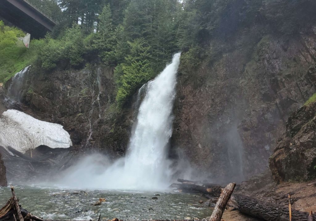
Twin Falls
- Distance: 2.6 miles
- Elevation gain: 500 feet
- Location: Olallie State Park
The trail to Twin Falls makes for a great quick hike near Seattle. It’s less than an hour away from downtown Seattle along I-90.
This trail leads hikers to a “twin” set of waterfalls (Upper and Lower Falls). Although Lower Falls is the larger, more picturesque waterfall, Upper Falls aren’t too far beyond and are worth viewing even if just for the chance to get in a little more hiking.
Eventually you’ll reach a fork in the trail where a set of stairs will lead you down to your right. These stairs will take you down to view the Lower Falls up close.
If you choose to view the Upper Falls as well, climb back up the stairs to return to the fork and continue on until you reach a bridge. On the bridge you’re standing above the Lower Falls; from here you can view the much smaller Upper Falls to one side and down into the river on the other side.
Related: The Ultimate List Of Waterfall Quotes & Captions For Instagram
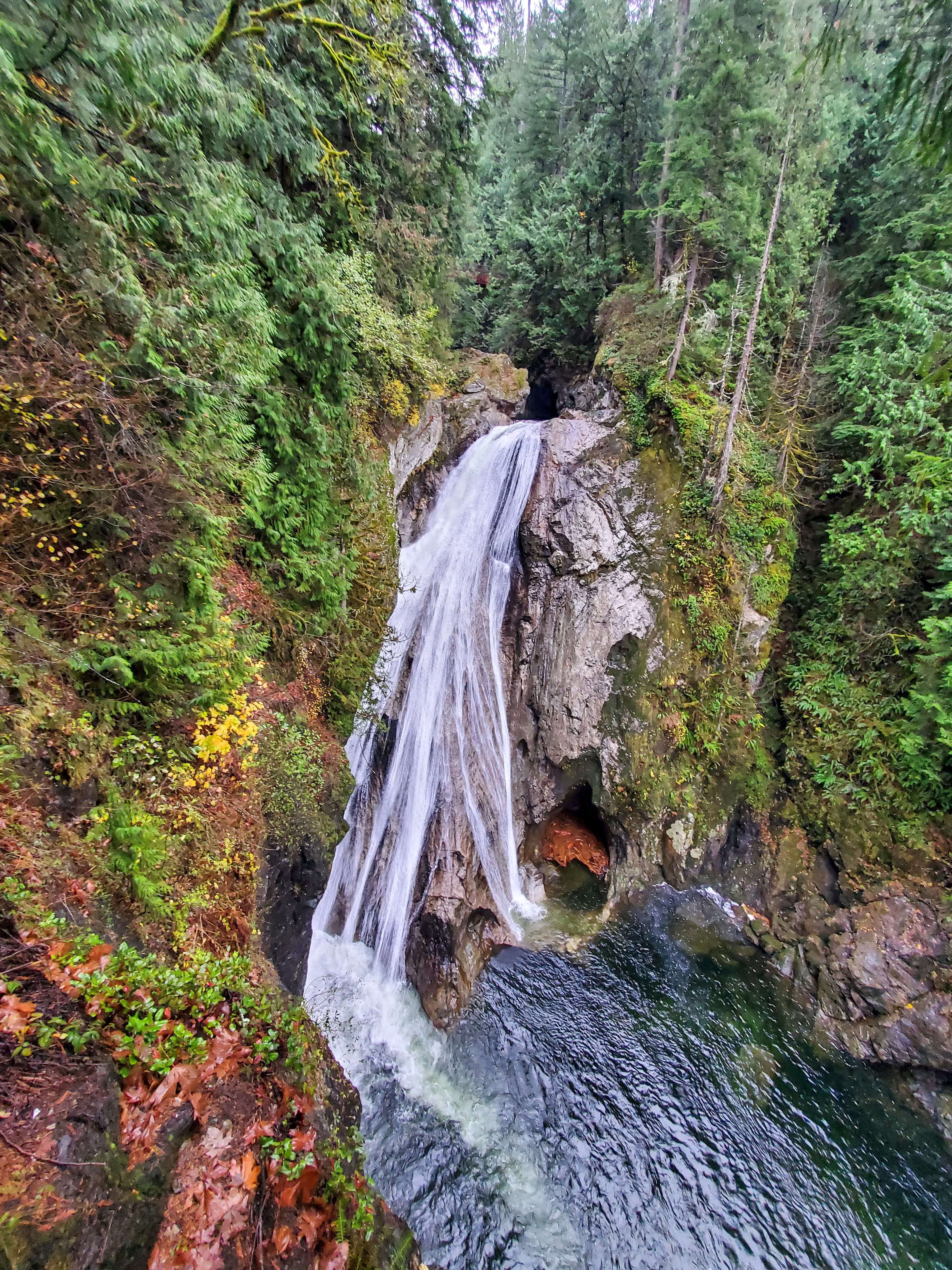
Silver Falls
- Distance: 3 miles
- Elevation gain: 300 feet
- Location: Mount Rainier National Park
Silver Falls is located in the Ohanapecosh area of Mount Rainier National Park.
This trail starts in the Ohanapecosh Campground. If you aren’t camping there, look for signs for the day use parking area. Once you’re parked, you can actually start this hike from one of two trailheads: either next to campsite B-2 in Loop B (near the visitor center) or near the campground amphitheater.
Once you reach the 40-foot waterfall there is plenty of space to relax and enjoy a nice picnic lunch near the falls. Just be very careful walking around the rocks because they can get slippery.
The gorgeous views of the falls for such a relatively easy hike definitely makes this trail worthwhile for hikers of any skill level.
Wallace Falls
- Distance: 5.6 mi
- Elevation gain: 1300 feet
- Location: Wallace Falls State Park
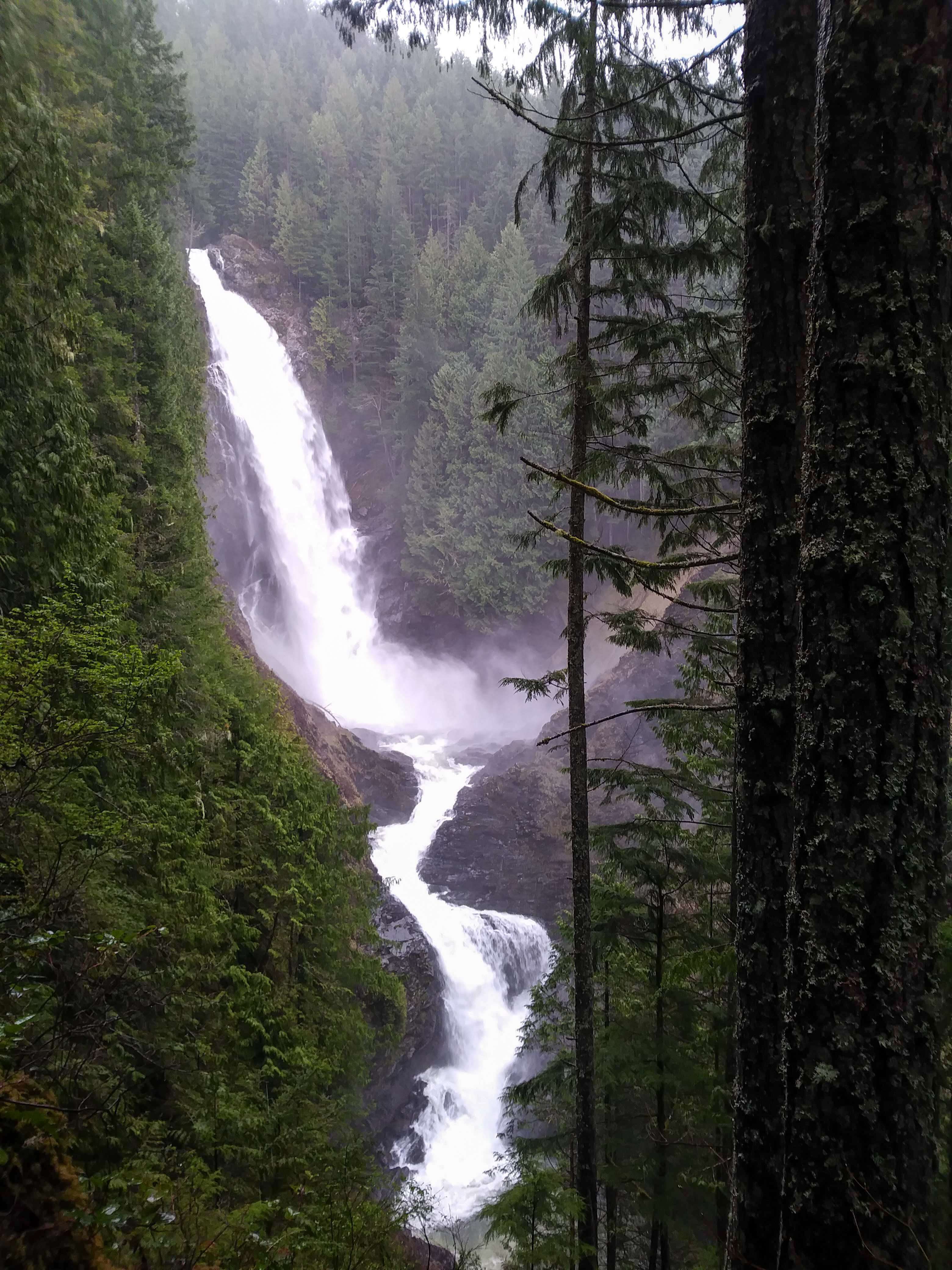
Wallace Falls is the most challenging hike in this section if you’re looking for a more moderate waterfall hike.
It makes for a great day hike from Seattle since it’s about an hour away from the city along Highway 2.
The trail will take hikers to three viewpoints of the lower, middle and upper falls.
The full distance and elevation gain listed is what you’ll hike to go all the way up to the upper falls, but the middle falls are the best view. It is the tallest of the three falls with a drop of 265 feet. If you want to want to make this hike even easier, you could stop and turn around at middle falls since the steepest part of the trail is after this point.
Related: 9 Beautiful Waterfall Hikes in Washington
Best Easy Coastal Hikes
Cape Flattery
- Distance: 1.5 miles
- Elevation gain: 200 feet
- Location: Olympic Peninsula

Cape Flattery is an incredibly easy hike that should be on every Washington hiker’s bucket list.
The trail takes hikers to the northwestern-most corner of the contiguous United States. How cool is that!
There are 3 turnoffs along the trail that offer views from different sides of the point.
This area is managed by the Makah Tribe. Hikers will need to purchase a Makah Recreation Pass to go on the trail to Cape Flattery.
Second Beach
- Distance: 4 miles
- Elevation gain: 310 feet
- Location: Olympic National Park
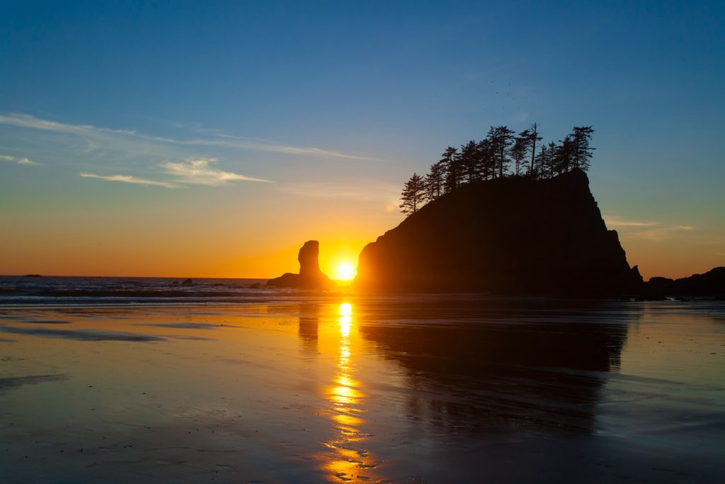
Second Beach is a favorite among the beaches on the Olympic Peninsula. The trail to access this beach also makes for one of the more interesting – but still easy – beach hikes.
At the beach you’ll get iconic views of the Pacific Ocean, sea stacks, and coastal wildlife.
Note that the main parking lot fills up fast. There is an overflow lot, but of course the walk from this lot to the trailhead will add on distance to your hike.
Oyster Dome
- Distance: 5 miles
- Elevation gain: 1050 feet
- Location: near Bellingham, WA
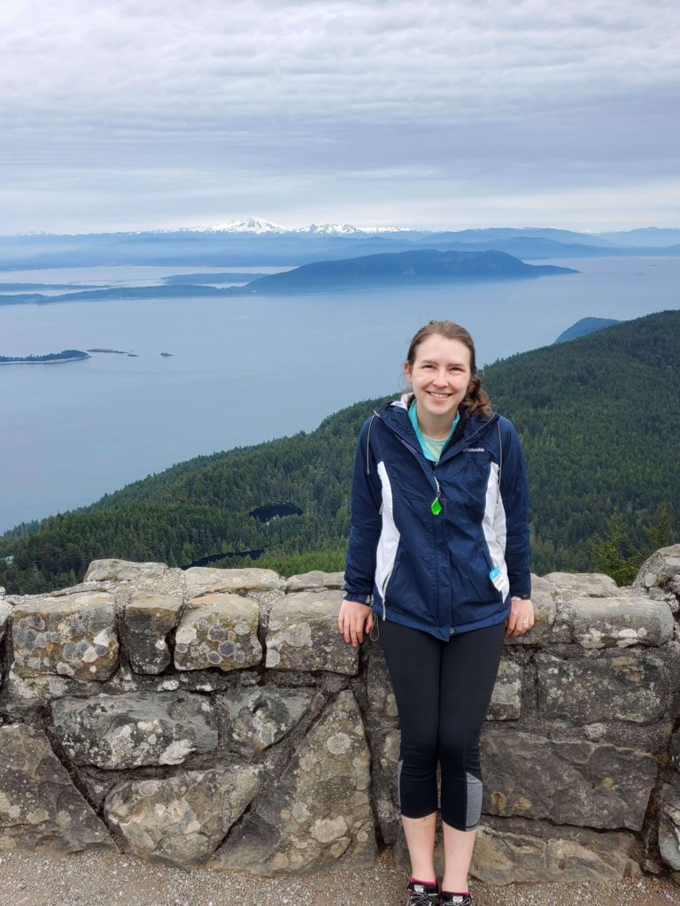
Oyster Dome is a great moderate day hike to a high up viewpoint. From here you’ll get a beautiful view of the San Juan Islands, Anacortes, and Vancouver Island further off in the distance.
Note that you can technically start the trail from 2 different starting points: Samish Overlook or an unofficial trailhead along Chuckanut Drive. Google Maps shows the Oyster Dome Trailhead along Chuckanut Drive, but there isn’t a parking lot here and starting here makes for a longer hike. On the flip side, getting to Samish Overlook requires driving on a bit of a rough road but by no means do you need an SUV to make it to the parking lot.
The view from Oyster Dome faces west over the Samish Bay so it makes for a nice sunset hike.
Related: 6 Spectacular Sunrise & Sunset Hikes Near Seattle
Little Summit to Mount Constitution
- Distance: 2.2 miles
- Elevation gain: 430 feet
- Location: Moran State Park on Orcas Island
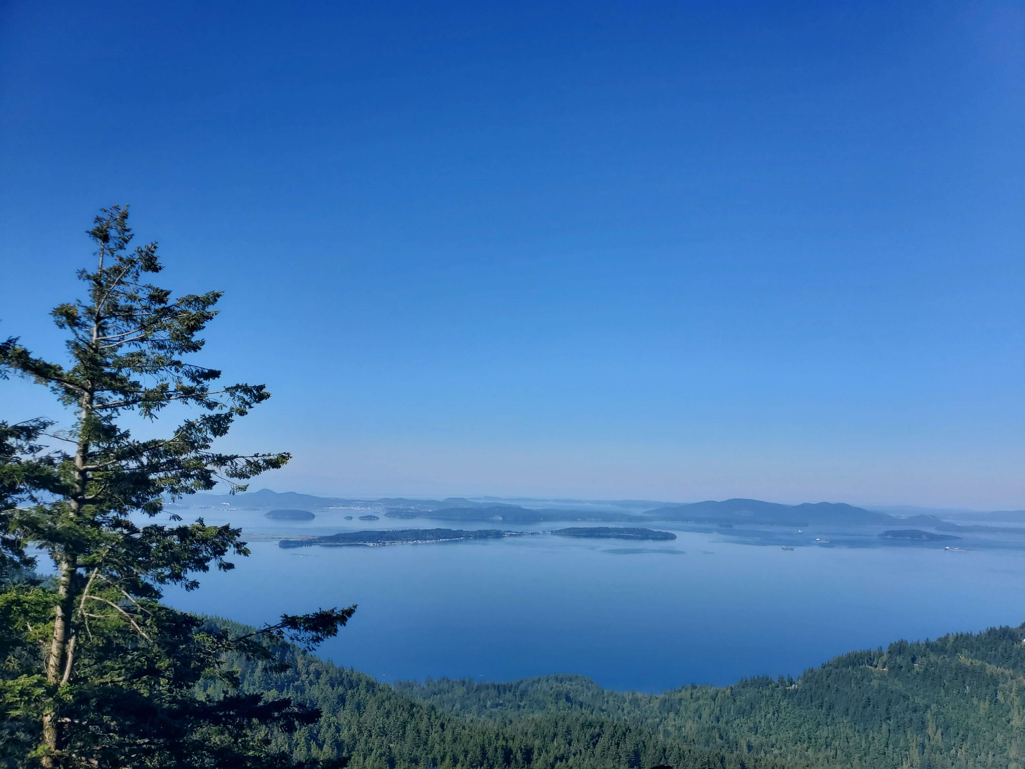
Mount Constitution is the highest point in the San Juan Islands and therefore offers insanely beautiful sweeping views. While you can drive up to Mount Constitution, I recommend hiking between Little Summit and Mount Constitution.
The hike between Little Summit and Mount Constitution is one of the best hikes on Orcas Island because you get an incredible view at both ends.
There is parking both at Little Summit and at Mount Constitution so you can start your hike at either end. If you want to tackle the uphill direction first, start at the Little Summit trailhead off of Mount Constitution Road.
From Little Summit, follow signs to Mount Constitution (or “tower”, referring to the watchtower at the top). Towards the end of the trail you’ll get a few peeks of the view to come, but just wait until you get to the top.
Up at Mount Constitution you’ll have sweeping views of the San Juan Islands, Vancouver, Mt. Baker and Mt. Rainier.
Related: Best Camping in the San Juan Islands