The Car Camper’s Guide to Lopez Island, WA
This post may contain affiliate links. When you make a purchase through an affiliate link on this site, I may earn a small commission at no additional cost to you. Read full disclosure here.
The San Juan Islands are the traditional lands of Coast Salish Peoples.
When you picture an island, you probably imagine a tropical destination with palm trees and turquoise water.
But did you know there are islands off the coast of Washington state?
The San Juan Islands are a group of islands in northwest Washington, and while they might not be the tropical beaches you typically imagine, they’re no less stunning.
The three main islands are San Juan, Orcas, and Lopez. Lopez Island is the most rural and slow-paced of the three.
We took a four-day camping trip to the islands with Lopez Island as our home base over Memorial Day weekend. And even though it was a holiday weekend, we never ran into any crowds!
The islands offer tons of opportunities to go bike packing, kayak camping, etc., but this guide is focused on the car camping experience.
Take notes before you set out because there’s limited cell service on the island unless you use T-Mobile!
Click on these links to navigate to a specific section in this guide:
- Campgrounds on Lopez Island
- How to Get to Lopez Island
- Traveling Between the San Juan Islands
- Things to Do
Campgrounds on Lopez Island
The first step in planning your Lopez Island camping trip is to scout out a campsite and lock in your dates.
Campgrounds are available on Lopez Island in Spencer Spit State Park, Odlin County Park, and several private campgrounds. We spent three nights at Odlin County Park, located right on the water at the northern tip of the island.
You can reserve a campsite at Spencer Spit and other state parks here up to nine months in advance of the start date of your reservation. For Odlin County Park and the other campgrounds in the San Juan Islands’ county parks, reservations open starting the first Wednesday in March (specific dates will be announced online) and can be made here. You can make a reservation at county campgrounds up to 90 days in advance.
How to Get to Lopez Island
There are several ways to get to the San Juan Islands: you could take the Washington state ferry system, seaplane, rental car or shuttle from SeaTac airport, or the San Juan Clipper. Of course, car campers can’t take their vehicles on a seaplane or shuttle, so the Washington state ferry is the way to go.
You’ll take the ferry from Anacortes, WA to get to Lopez Island. Check out the ferry schedule to and from Anacortes here.
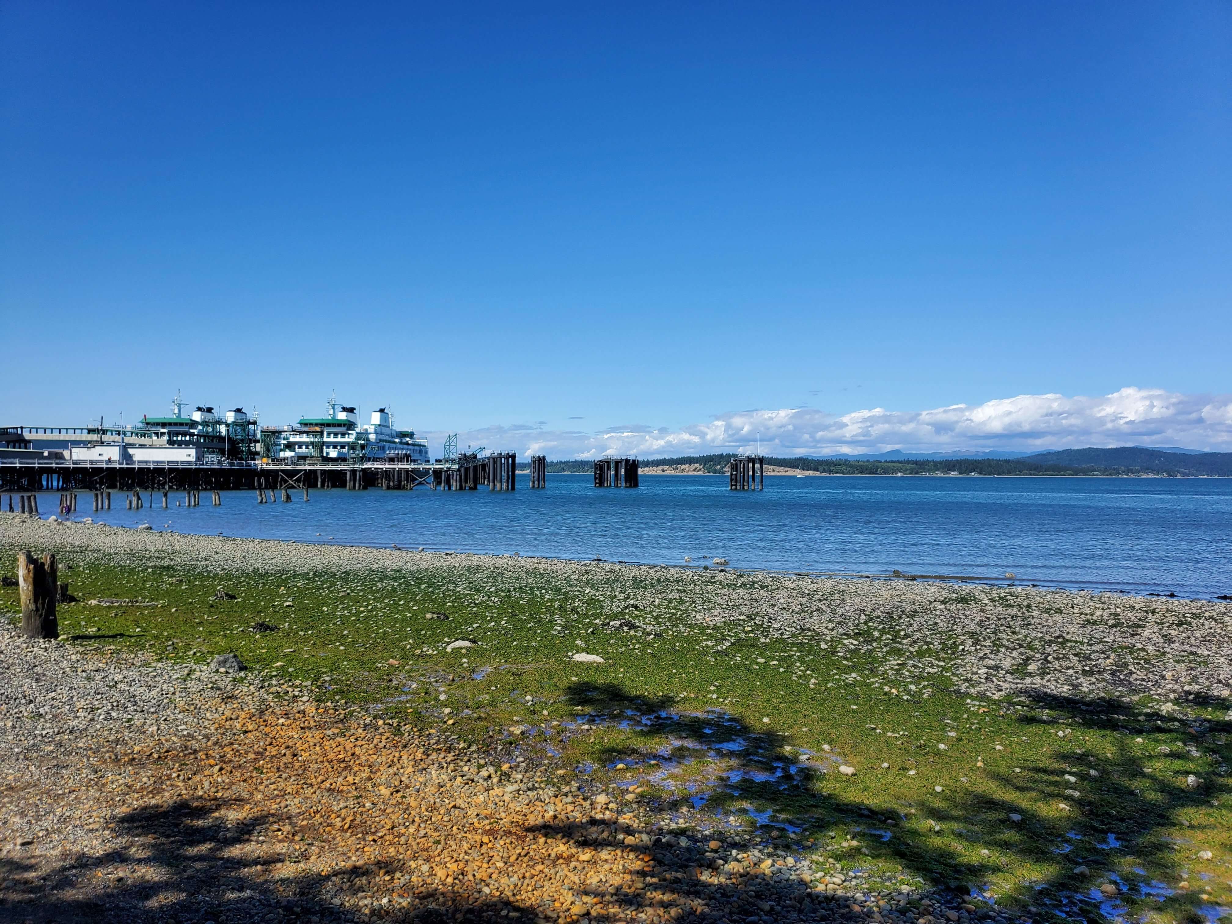
Drivers need to pay to take their vehicles on ferry to the islands but the return trip is free. You can make a reservation to bring your vehicle on the ferry from Anacortes to Lopez Island here. (Note that this reservation is not your ticket and you will still need to pay for your ticket when you arrive at the ferry terminal. Reservations are not required but are recommended).
Pit Stop: Deception Pass State Park
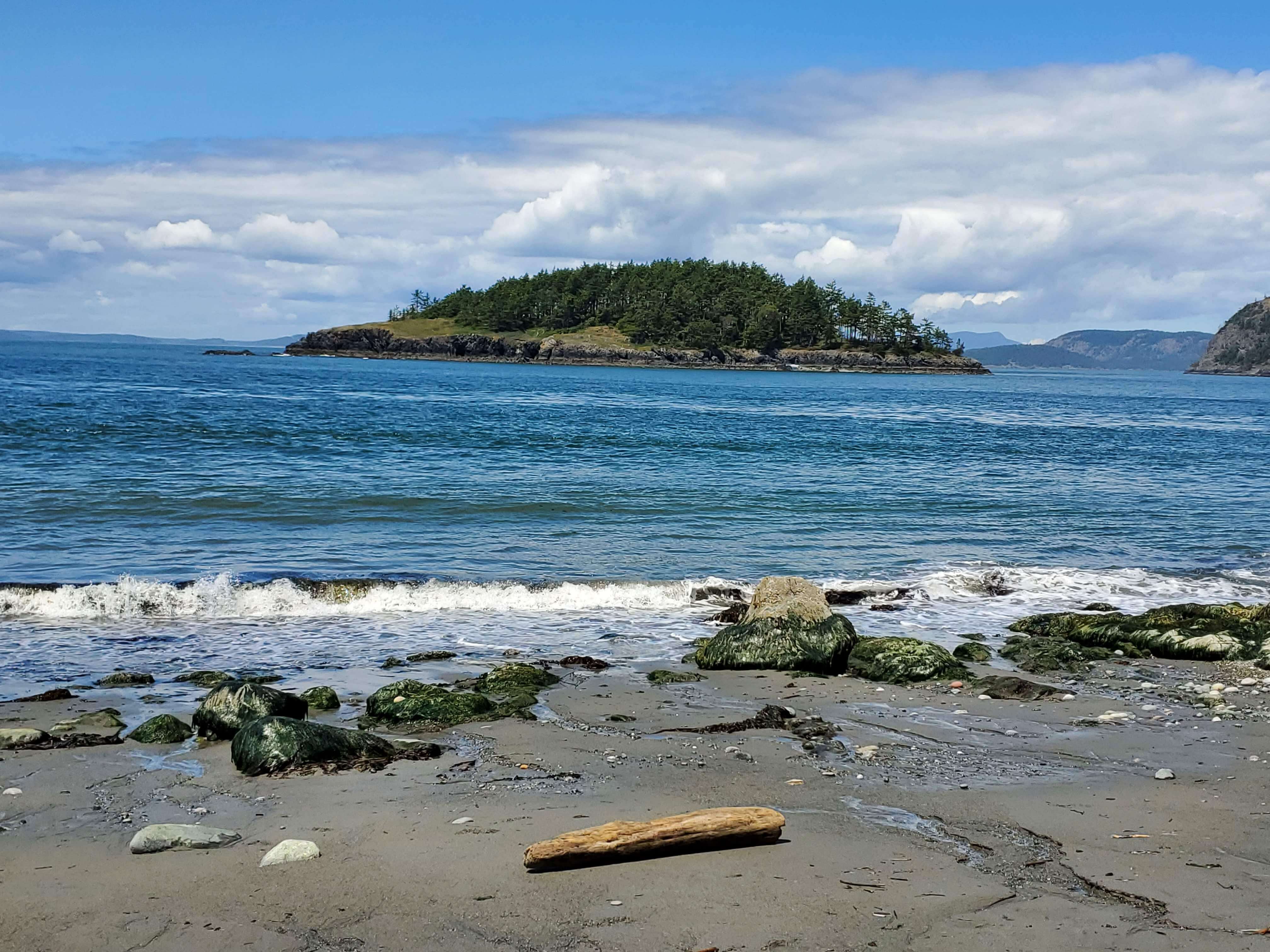
If you’re traveling from Seattle or anywhere else south of the islands, there are two ways to get to Anacortes: driving north up I-5 or taking a detour through Whidbey Island. If you have a few extra hours on either end of your trip, I suggest driving straight to Anacortes one way and going through Whidbey Island on the other leg of the trip to stop at Deception Pass State Park.
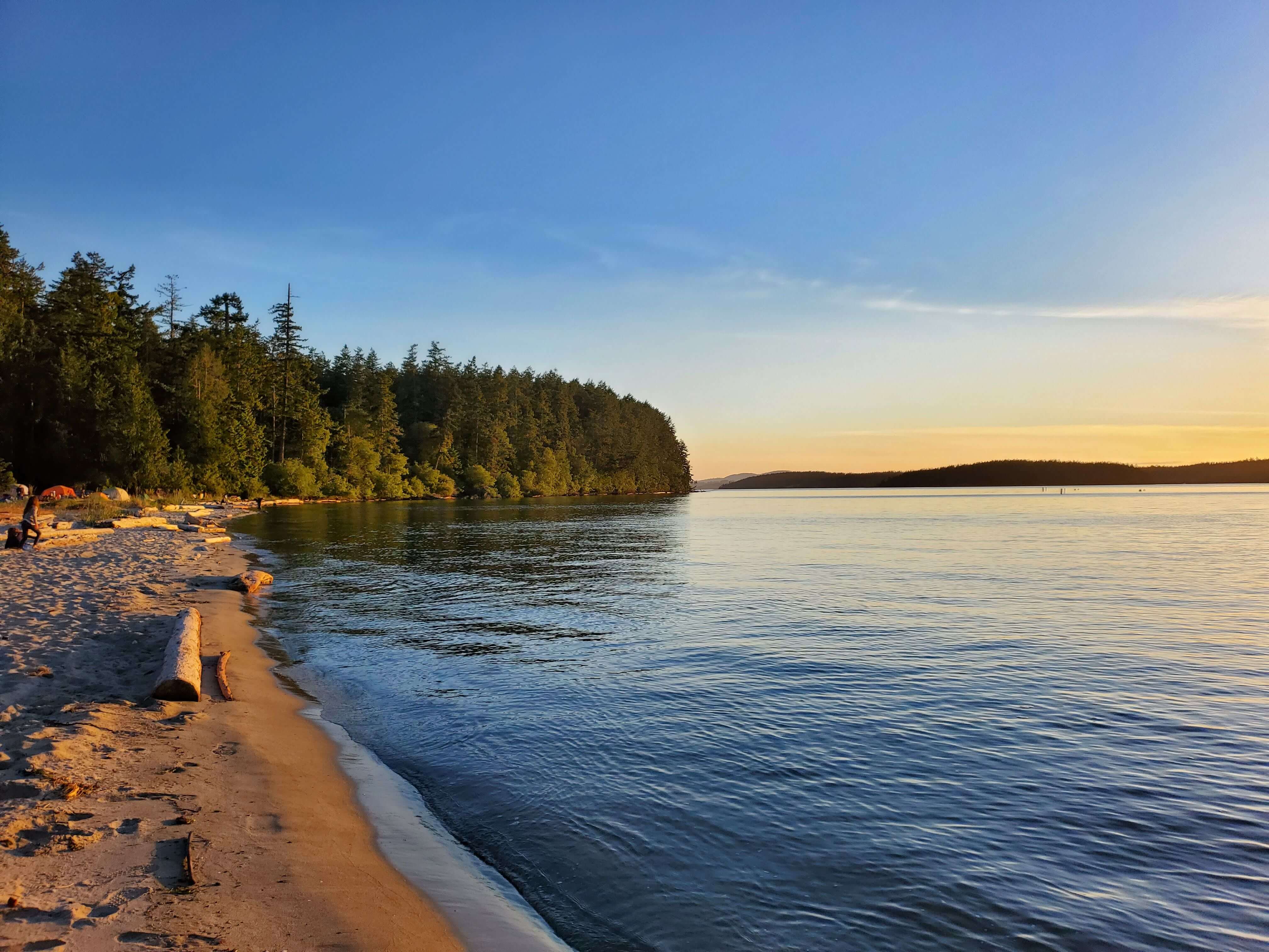
Deception Pass is the most visited state park in Washington, so you know there are awesome sights to see there. I recommend walking along West Beach and North Beach over to the Deception Pass Bridge. I mean come on, check out this view of Deception Island (and the San Juan Islands beyond it) from West Beach!
We had a few hours to spend in Deception Pass since we had reservations for a late afternoon ferry, so we also walked along most of the trails throughout the park. While walking along these trails we saw two bald eagles and a snake! I insisted on doing the short but steep hike up to Goose Rock because it’s the highest point in the park and therefore supposedly has great sweeping views, but honestly I thought the views were better down at the beach (and no steep hike required to see them).
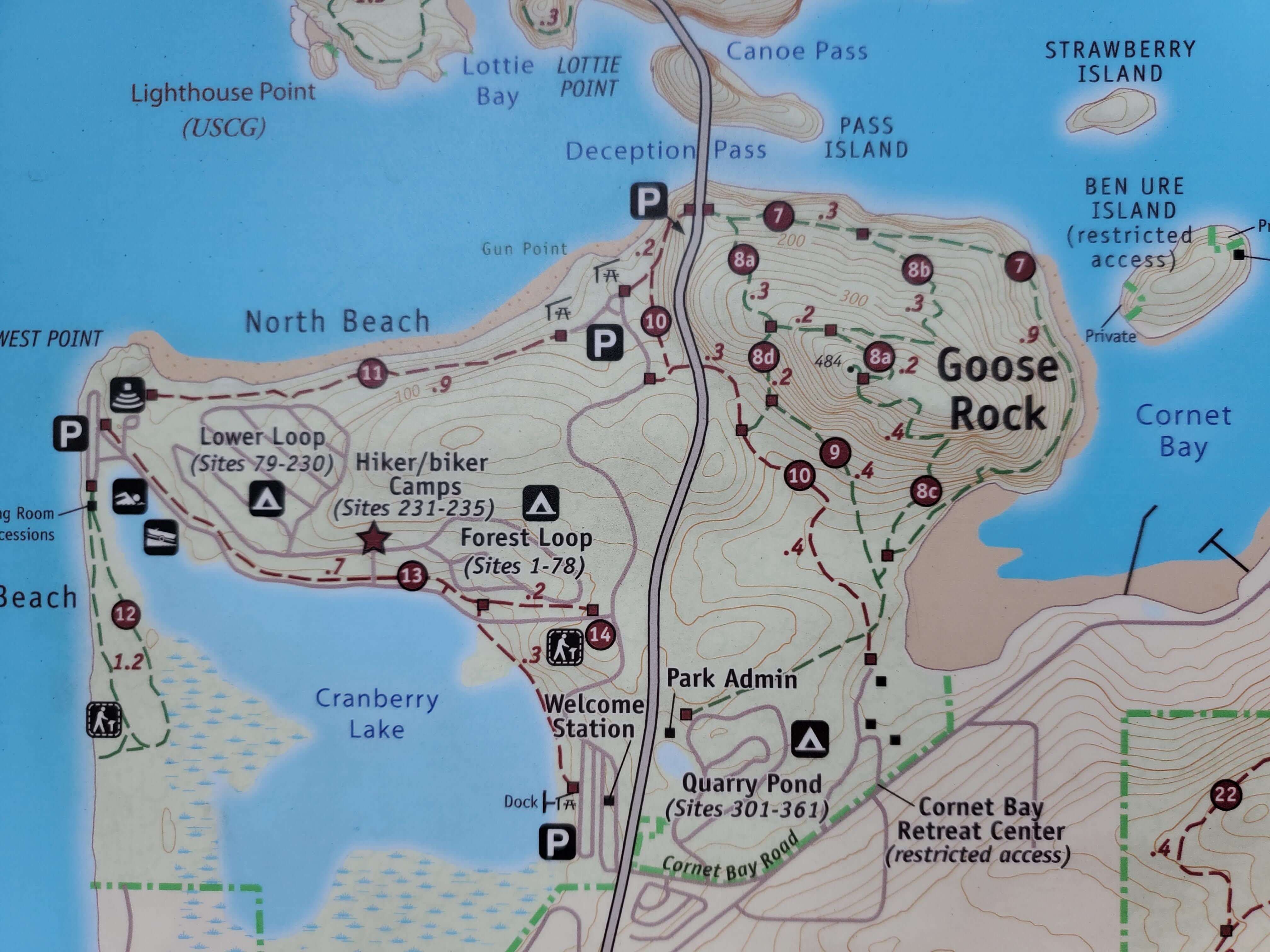
Note that you’ll need a Discover Pass to park in Deception Pass; if you don’t already have the annual pass, you can buy a one-day or annual pass once you’re there. You’ll also need to take an additional ferry between Mukilteo and Clinton.
Traveling Between the San Juan Islands
If you intend to spend any time on other islands besides Lopez during your camping trip (which I recommend in the hiking section below), you’ll need to take the interisland ferry.
When you arrive at the Lopez ferry terminal, get in the lane that corresponds to the island you want to travel to.
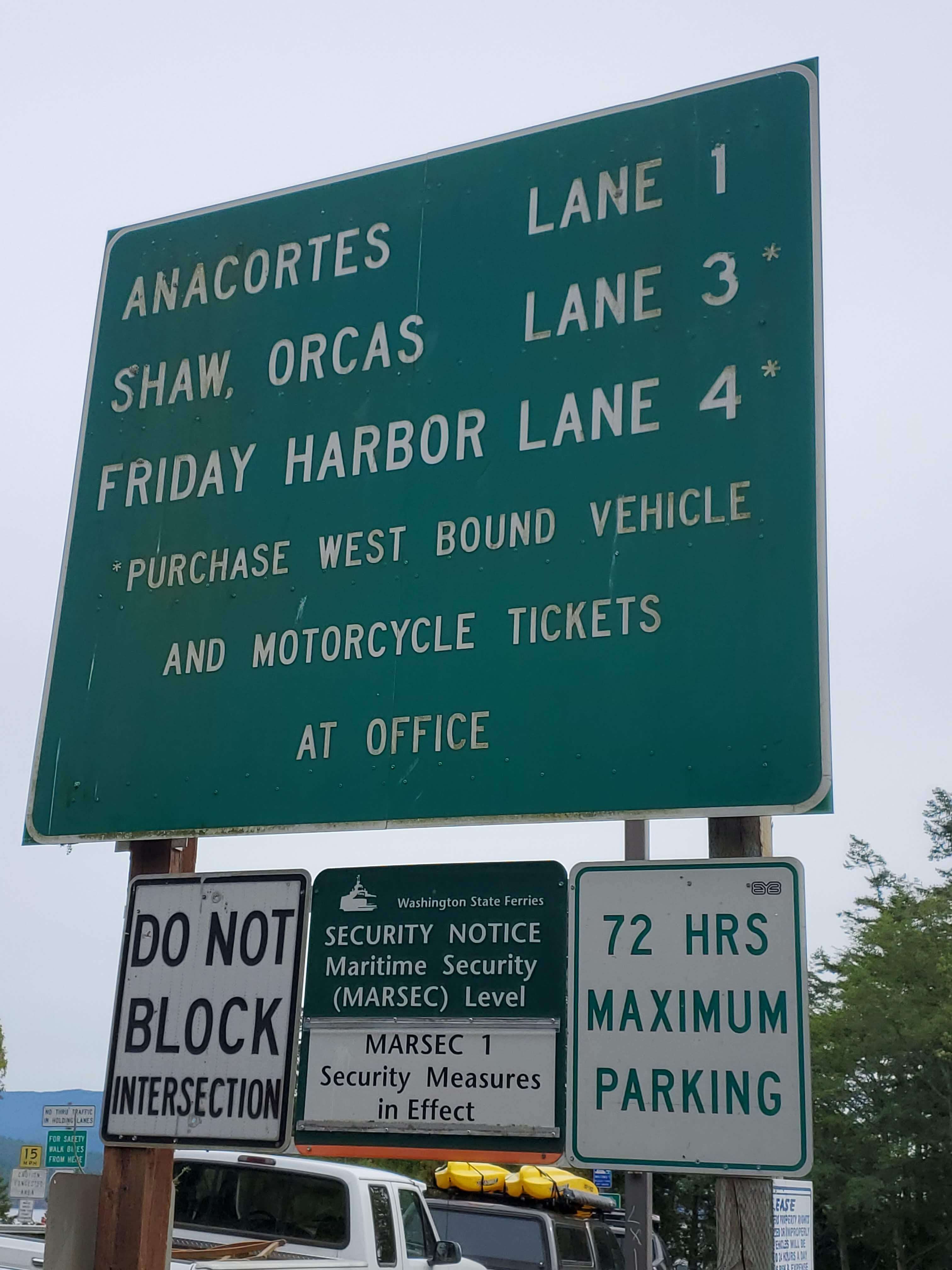
As with the ferry trip from Anacortes to Lopez, you need to pay for a ticket to bring a vehicle on westbound routes (i.e. leaving Lopez to go to the other islands) but you don’t need a ticket to return to Lopez. Once you’ve parked in the appropriate lane, purchase a ticket in the office at the front of the lanes on the right hand side. There’s a kiosk in there to purchase your ticket if you’re paying by card.
You can find the schedule for the ferry trips between the islands here.
Things to Do
While the San Juan islands provide plenty of vacation experiences such as shopping, dining, and spas, I’ve focused this guide on outdoorsy activities in line with a more typical camping experience. Below are my recommended options to get out in nature while camping on Lopez Island.
View Points on Lopez Island
There are a number of great views from the parks and beaches all around Lopez Island. Check out the map of featured parks and beaches from Lopez Bicycle Works & Kayaks below for a full list of recommendations. Since the island is fairly small, you could hit them all in a day depending on how much time you spend at each spot.
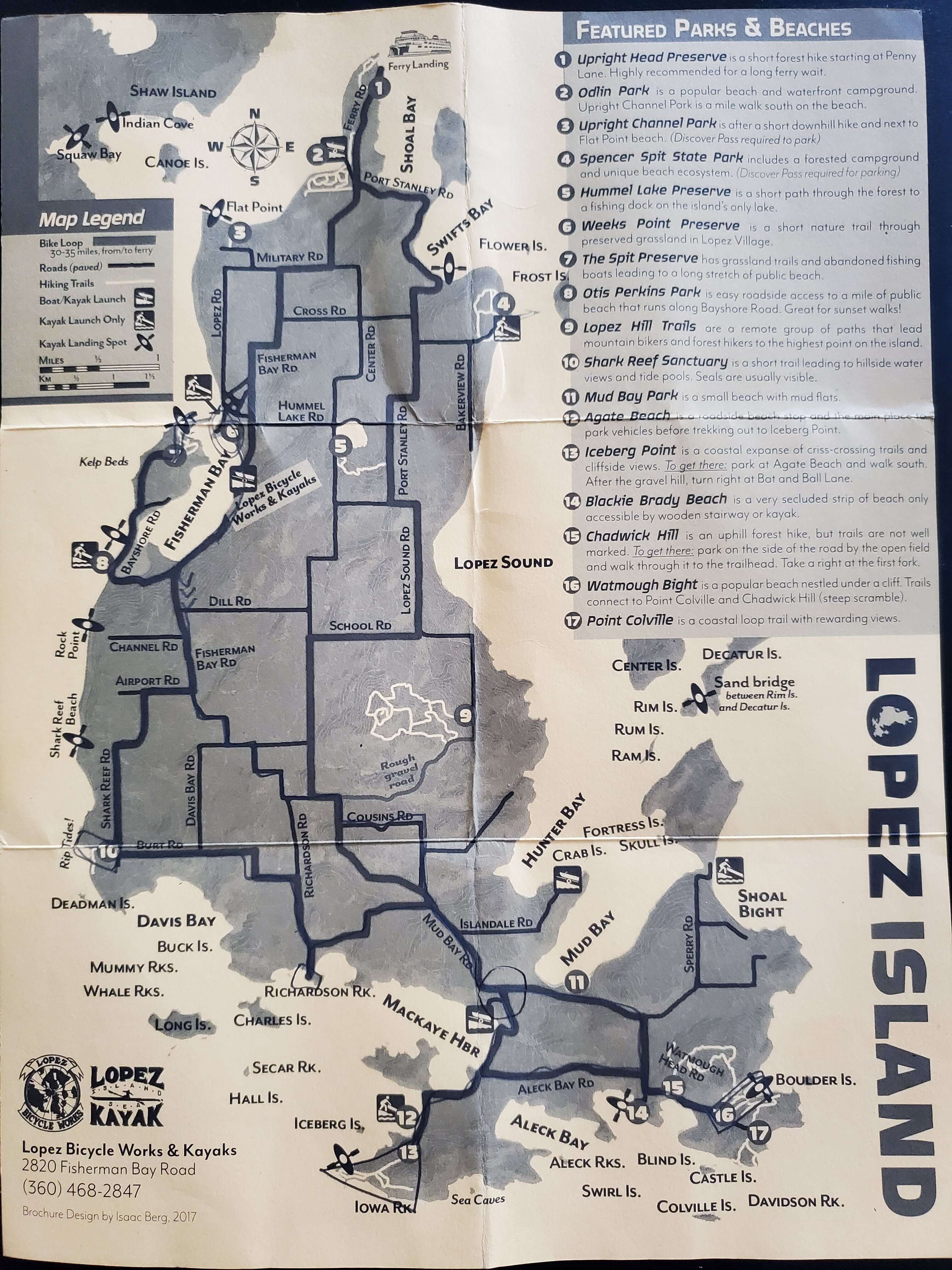
We toured the island by bike, so we narrowed down our list of destinations to the best of the best spots as recommended to us by a local resident.
Shark Reef Sanctuary
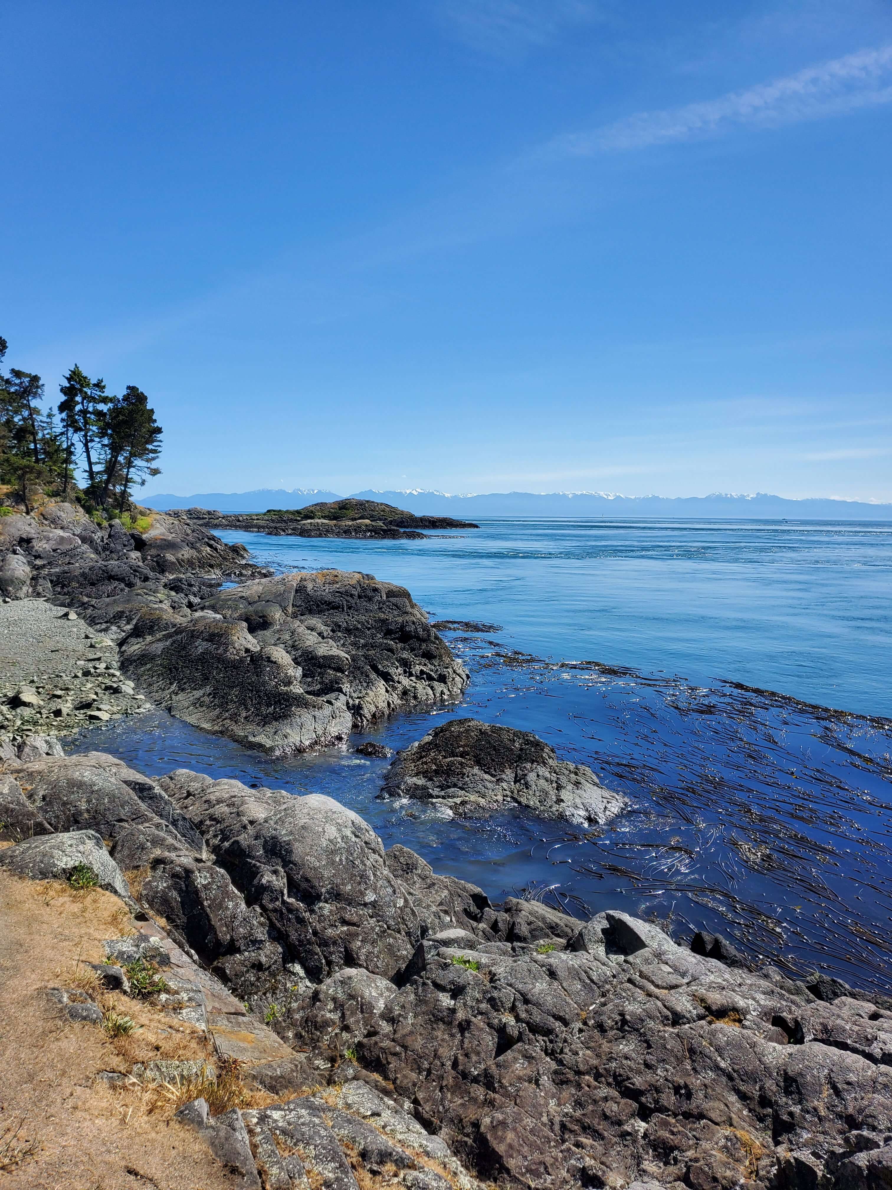
Shark Reef Sanctuary is on the west side of Lopez Island. Take the flat one mile (roundtrip) trail to access views of San Juan Island directly before you and the Olympic Mountains looking to the southeast.
Southern End of Richardson Road
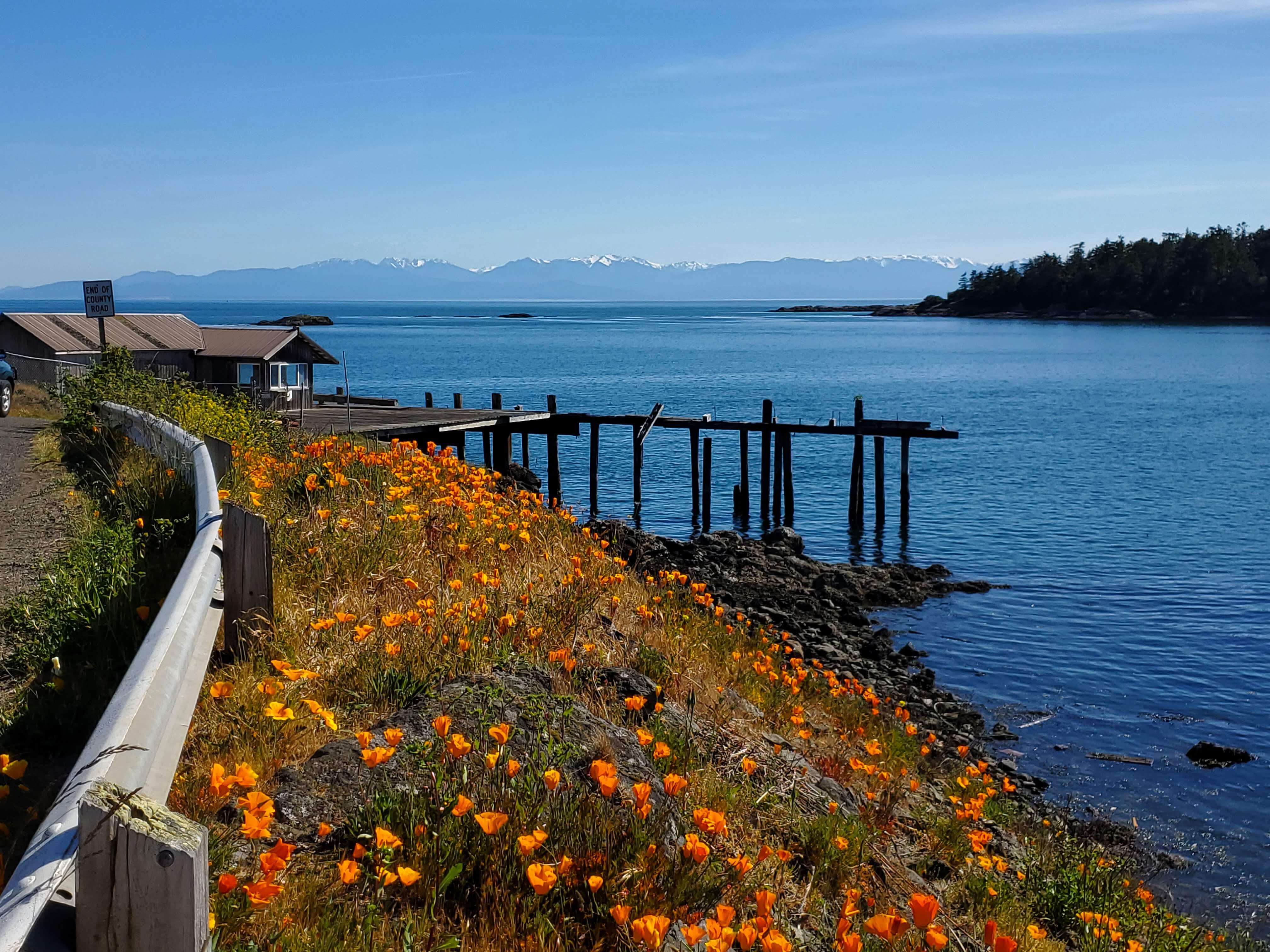
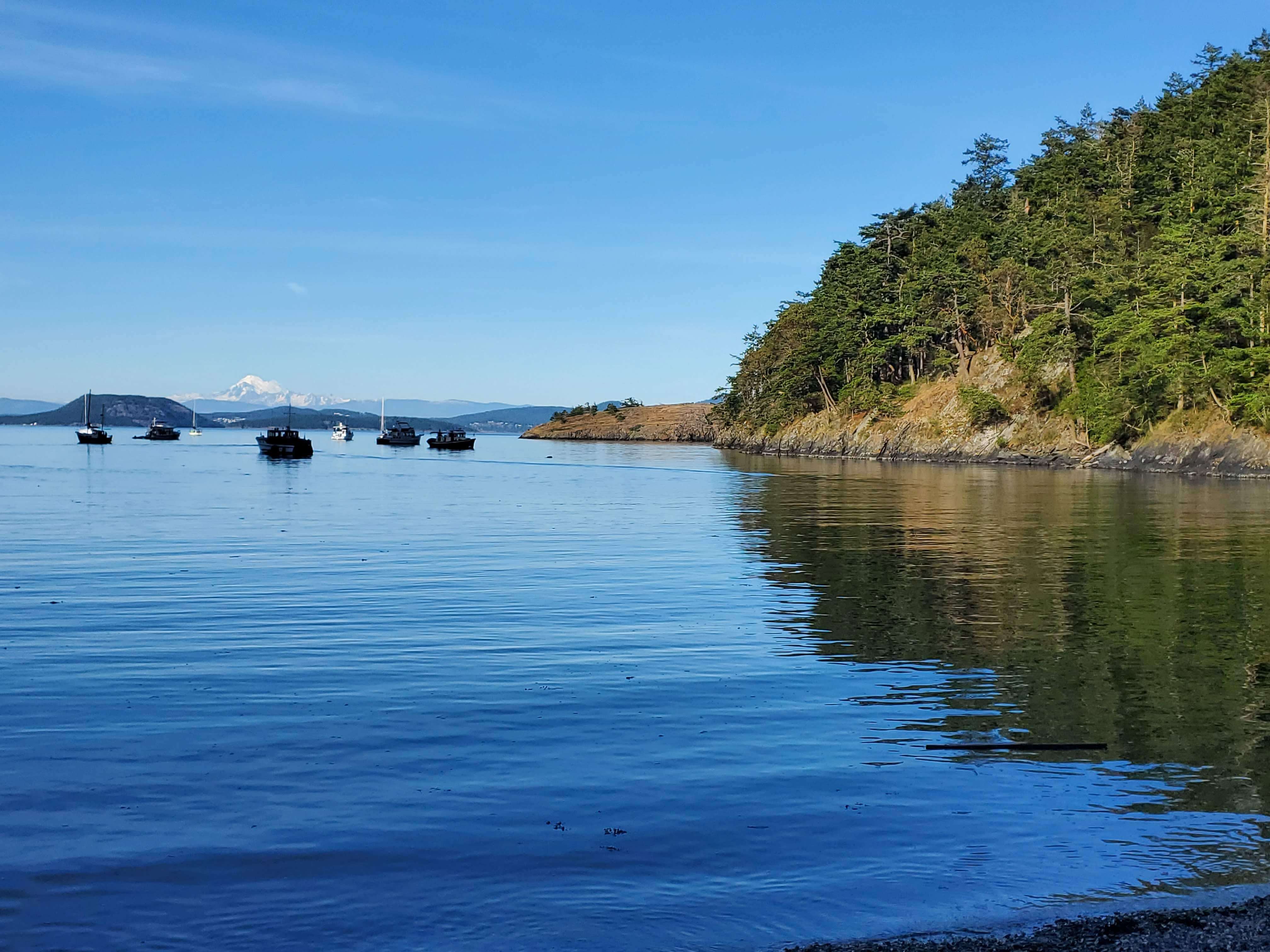
Richardson Road is located in the south central part of Lopez Island. The road dead ends along the island’s southern shore at an old gas station. It’s easy to completely ignore the gas station, though, as your eyes are immediately drawn to Richardson Rock, the surrounding water, and over to the Olympic Mountains.
Agate Beach and Iceberg Point
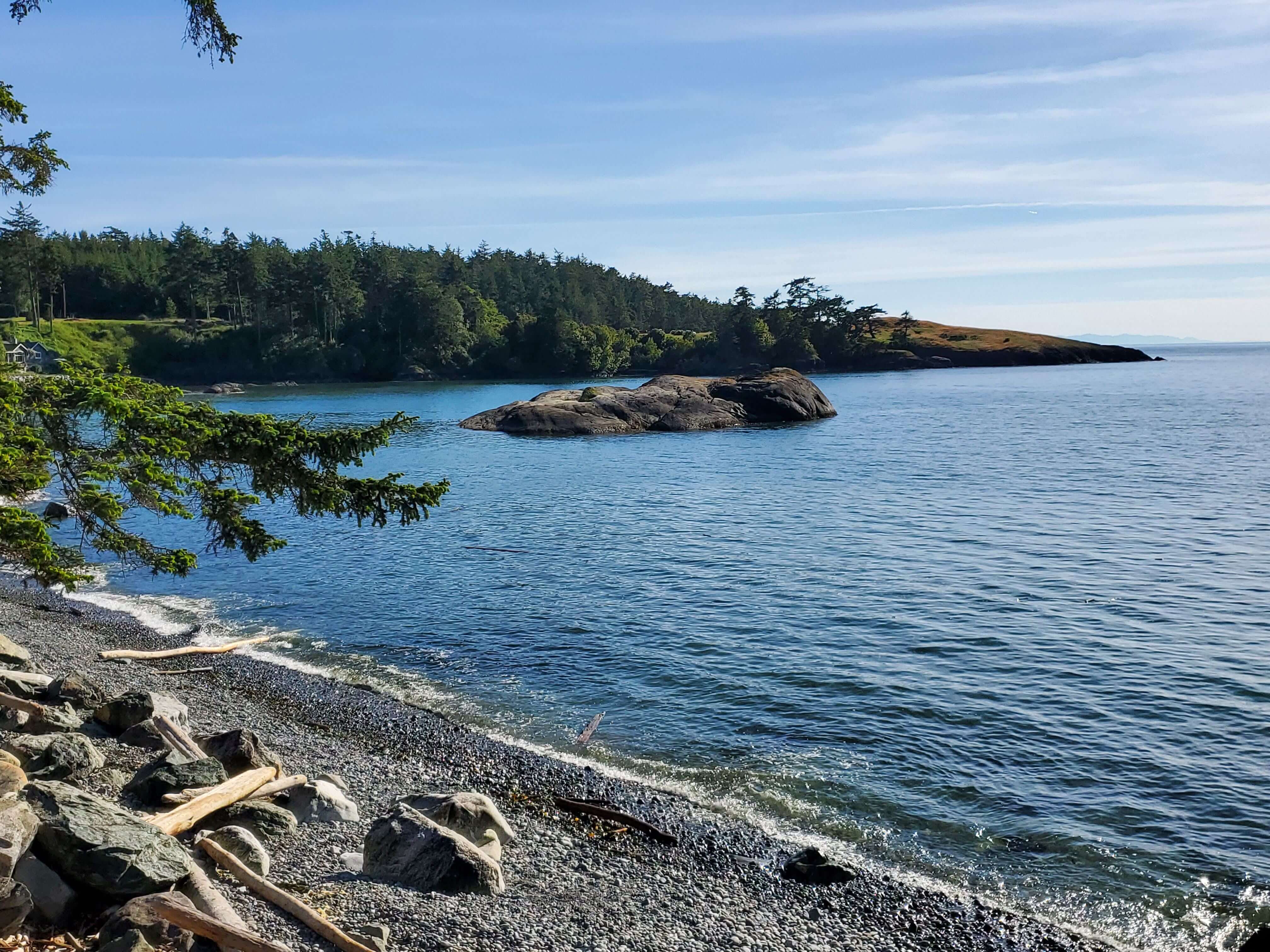
So looking back at our yellow map after our bike ride, I realized that we stopped at Agate Beach but we had actually been recommended to stop at nearby Iceberg Point. To get to the sweeping cliffside views at Iceberg Point, you need to park at Agate Beach and THEN walk over to Iceberg Point. Agate Beach is an excellent bonus viewpoint if you’re heading over to Iceberg Point, but as you can see from the picture above, Agate Beach is worth the stop on its own!
Watmough Bay
Watmough Bay is in the very southeast corner of Lopez Island. This was the last stop on our bike tour, and while I was really struggling to stay on my ill-fitted rental bike by this point, I thought the pain was all worth it when we got to this gorgeous, uninterrupted view of Mt. Baker framed by the surrounding cliffs (which my phone camera couldn’t fully capture, so you definitely have to go see it for yourself!).
Kayaking
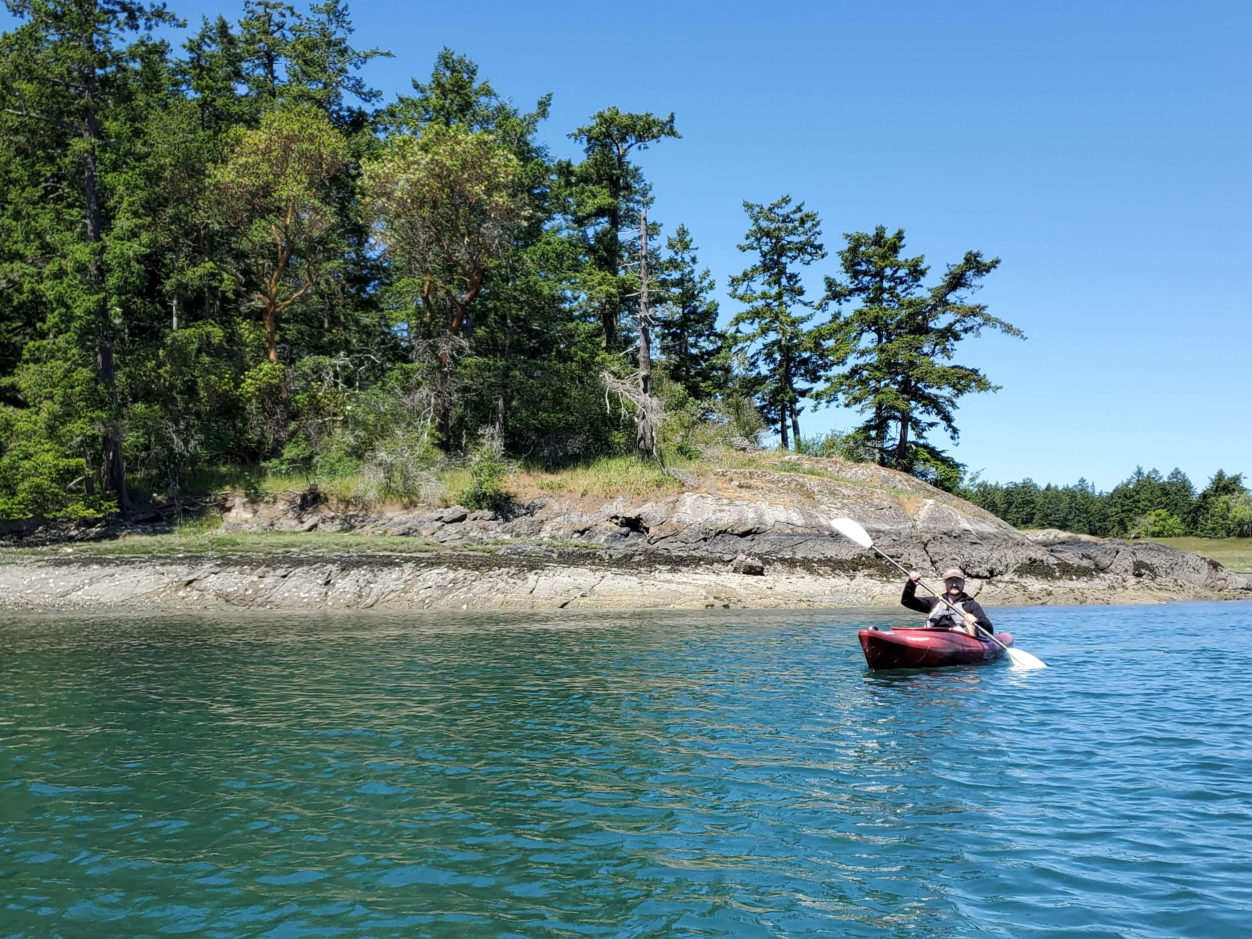
Is it even possible to go to an island without getting on a boat? With so much direct access to the water, I considered kayaking to be a must-do activity on our camping trip.
You can rent kayaks from Lopez Bicycle Works & Kayaks. Their hours aren’t posted anywhere online but they’re open 10am-5pm.
Both standard and touring kayaks are available to rent by the hour or day. Day-long rentals are for 24 hours; they let you leave and come back for your kayak within those 24 hours!
We went with the standard kayaks and paddled around the calm waters of Fisherman Bay. One of the highlights was seeing a harbor seal pop its head out of the water!
Hiking
There are plenty of trails on Lopez Island, but most of these are two miles or less round trip and essentially flat. If that’s your cup of tea, I encourage you to learn more about these trails from the San Juans Visitors Bureau website.
If you’re looking for trails that are a bit more challenging, I recommend you take the interisland ferry over to Orcas Island. Moran State Park alone has a network of almost 40 miles of trails, which you can connect to make as long, short, or challenging of a hike you choose.
Note that you’ll need a Discover Pass to park in Moran; if you don’t already have the annual pass, you can buy a one-day or annual pass once you’re there.
Once you’ve made it to Orcas Island, lace up your shoes and head to one (or more) of these trails. These trails are more intense than what you’ll find on Lopez Island, but short enough that you’ll have time to complete them before catching the ferry back to Lopez.
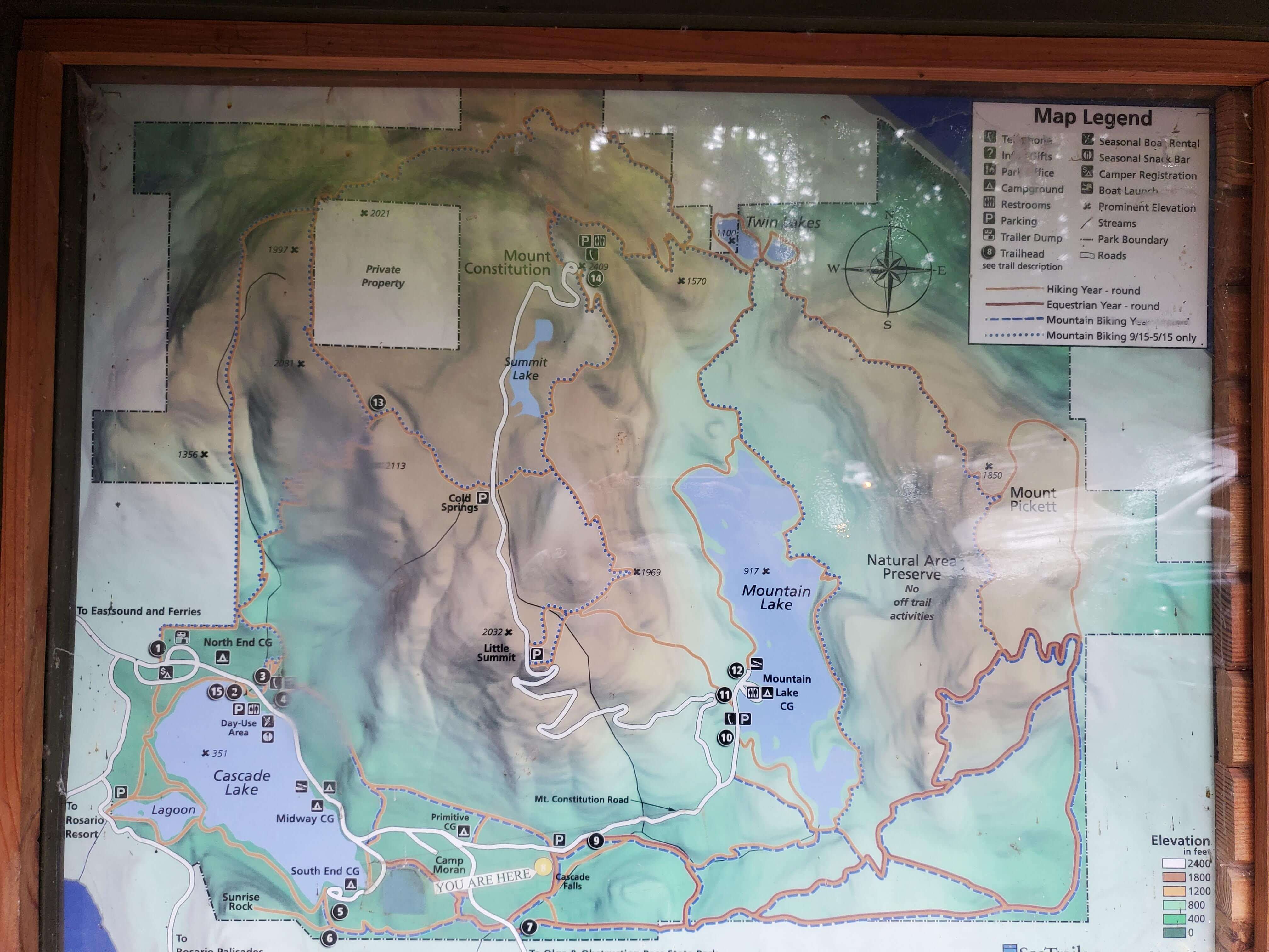
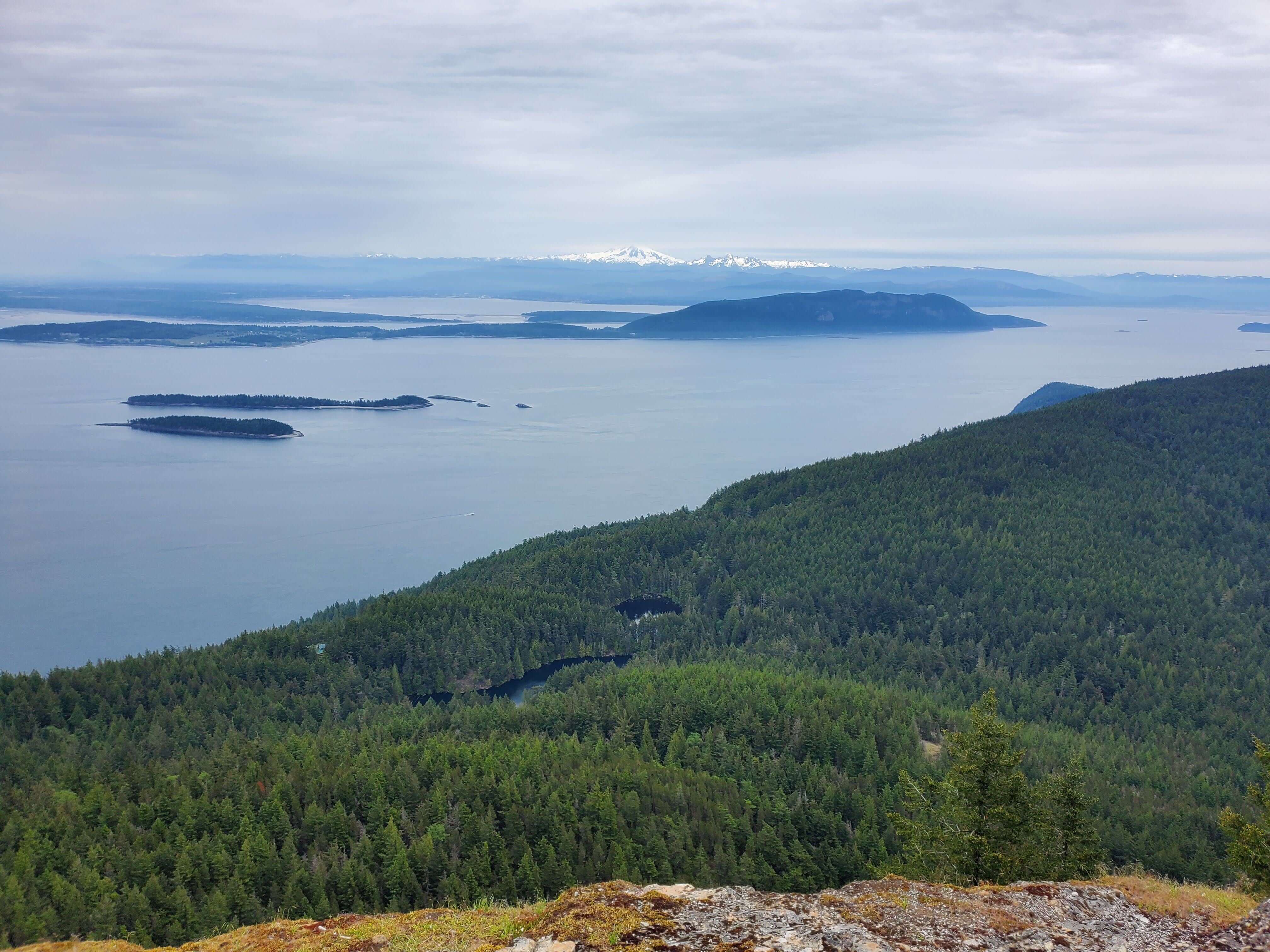
Little Summit to Mount Constitution
This hike is a great bang for your buck because you get two of the island’s fantastic views out of it. Mount Constitution is the tallest point in all of the San Juan Islands at over 2,400 feet, so it is THE viewpoint to see on your trip.
You can drive to both Little Summit and Mount Constitution, but hiking between them is much more rewarding.
It’s a 4.4 mile hike round trip between these two spots. You can park at either location; we started at Mount Constitution, but if you want to tackle the uphill direction first, start at the Little Summit trailhead off of Mount Constitution Road.
Follow signs for the short walk from the Little Summit trailhead to Little Summit to access a picnic area and a great view of the islands right off the bat. How often do you get to START a hike with a view like this??
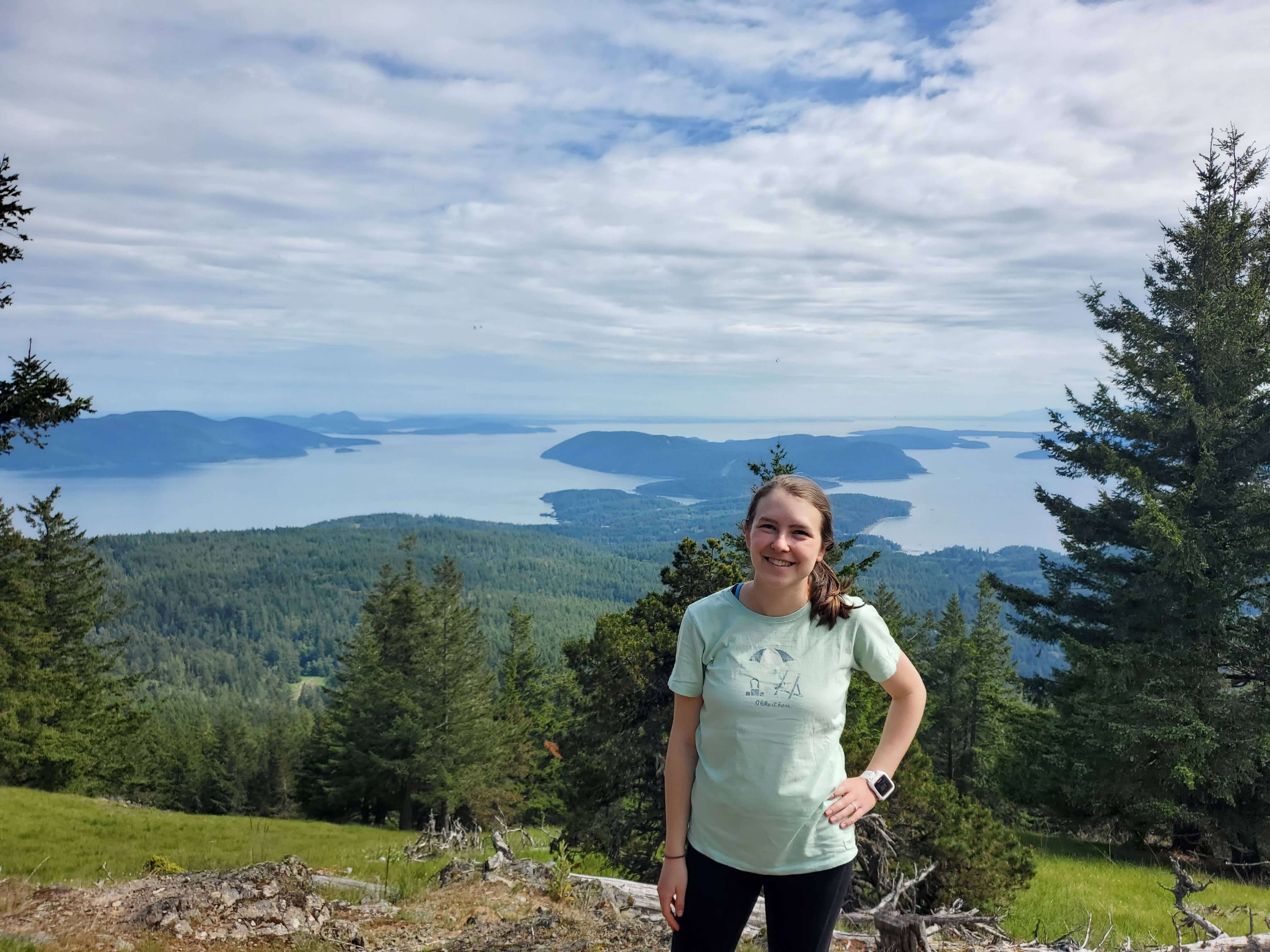
Once you’ve had your fill of the views, follow signs to Mount Constitution (or “tower”, referring to the watchtower at the top). Towards the end of the trail you’ll get a few peeks of the view to come, but just wait until you get to the top.
From Mount Constitution you’ll have sweeping views of the San Juan Islands, Vancouver, Mt. Baker and Mt. Rainier. Even on an overcast day we were impressed with the sight in front of us.
Turtlehead Summit
Turtlehead Summit is the second highest point in the San Juan Islands, so the views from here are raved about as well!
This is the only hike on this list that isn’t located in Moran State Park. It’s located in Turtleback Mountain Preserve on the west side of Orcas Island.
Washington Trails Association lists this hike at 5.7 mi roundtrip with 1,295 feet of elevation gain starting from the North trailhead, but you’ll rack up some extra distance if you stop at all of the overlooks along the trail or add on any of the connecting trails.
Cascade Falls Trail
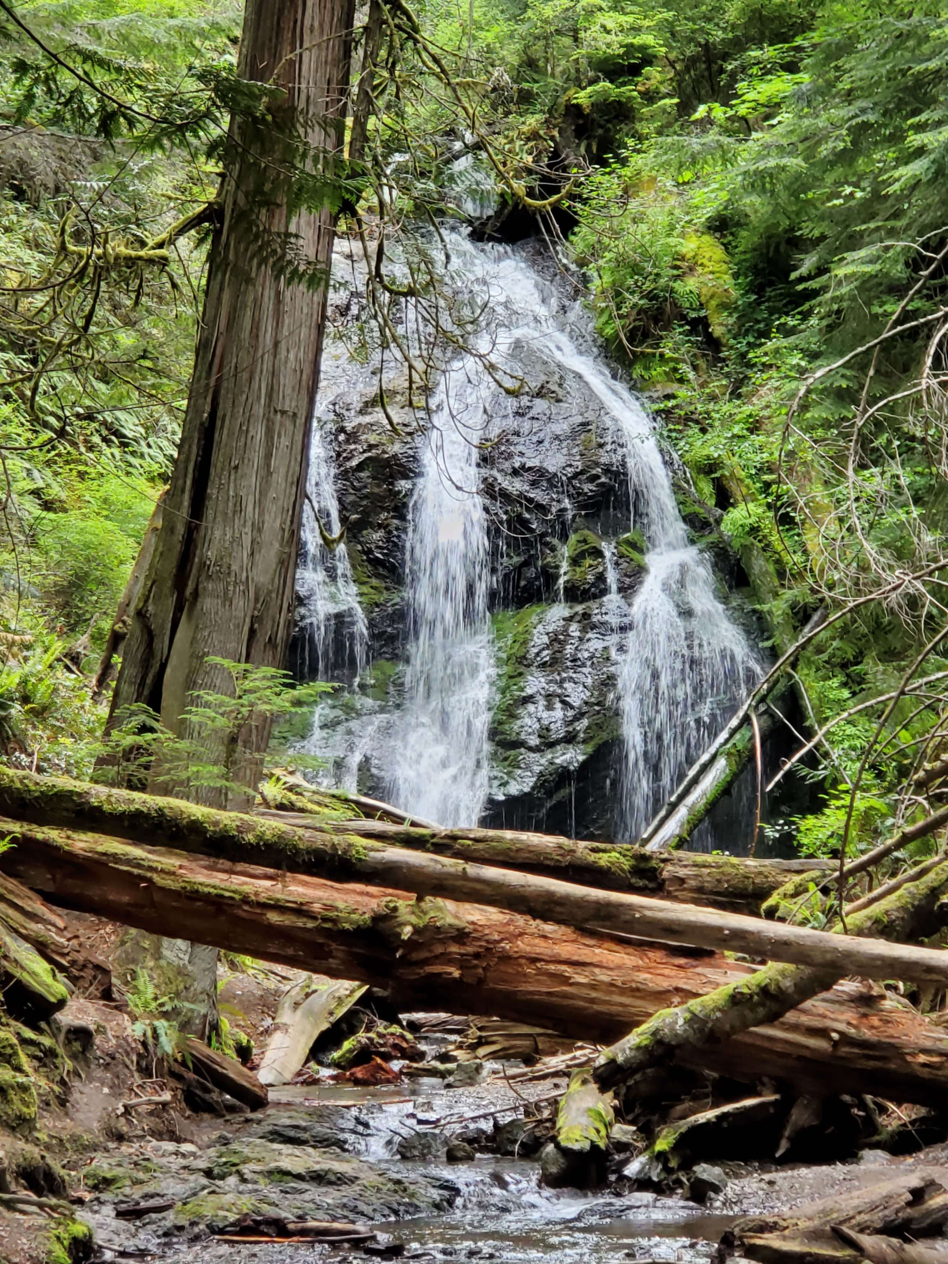
Although it’s not very far at all to walk from the trailhead to Cascade Falls itself, this trail includes signage that leads you to three additional waterfalls for a roundtrip hike of about a mile and a half.
Cascade Falls is the tallest waterfall in the San Juan Islands. There are both upper and lower viewpoints so you can check it out from multiple vantage points.
Once you’ve gotten your fill of the falls, backtrack to the sign at Rustic Falls to head in the direction of Cavern Falls and Hidden Falls.
Hidden Falls is aptly named because eventually the signs stop directing you to it and it’s not labeled! It’s also located under a bridge, so you have to be ready to look down; it’s not going to be in your face. If you’ve gone this far, turn around and head back to the trailhead from this point as this is the last waterfall.
Sunrise Rock
I can only imagine Sunrise Rock must have amazing sunrise views, but don’t expect to make it by sunrise if you’re heading here from Lopez Island.
This hike is relatively short at 1.4 miles roundtrip, but you’ll get your heart pumping as the last quarter mile of the trail is steep. For a longer hike, follow signs to connect to Cascade Falls and follow the hike above.
Interested in more places to camp in Washington? Here are more camping articles to check out:
- 10 Best Lakes With Campgrounds In Washington
- Best Camping in the San Juan Islands
- Camping On Vashon Island: 5 Unique Places To Camp
- The Car Camper’s Guide to North Cascades National Park
- The Camper’s Complete Guide to Visiting Olympic National Park
- Things to do at Lake Chelan: A Guide for Outdoor Adventurers
As always, enjoy the outdoors responsibly. Leave no trace on all of your adventures.