15 Easy Hikes in Shenandoah National Park (With Trail Maps)
Shenandoah National Park has so many easy hikes that reward you with a great experience for little effort.
Whether you’re short on time, hiking with kids, or just aren’t feeling up for a major hike, these easy hikes in Shenandoah National Park are great for every hiker.
There are over 500 miles of trails throughout the park, so it can be overwhelming narrowing down the list to select one (or a few!) hikes you’d like to do. I’ve compiled this list of easy hikes in Shenandoah National Park so you can spend less time researching and more time hiking.
Most of these trails are less than 3 miles long, but I’ve also included a few that are longer than 3 miles in case your standards for “easy” hikes are a bit higher.
Ready to dive in? Here are 15 easy hikes in Shenandoah National Park.
Know Before You Go
- Shenandoah National Park encompasses 105 miles of Skyline Drive. This road has numbered mileposts along it. I’ve included the number of the nearest milepost to each hike so you can find where each trail starts in the park.
- All of the hikes on this list are fairly short, but some are steeper than others to pay attention to the elevation gain!
- Many hikes in Shenandoah National Park are located among a network of trails. I’ve included links to the national park’s trail maps with directions so you can identify the correct trail when you arrive.
- New to hiking? Here’s what I bring on every hike.
- Learn the leave no trace seven principles to avoid harming the local ecosystem and fellow visitors during your hike.
Easy Hikes with Great Views in Shenandoah National Park
Bearfence Viewpoint
- Distance: 1.1 miles
- Elevation gain: 305 feet
There are several viewpoints along the Bearfence Loop Trail. But the route to Bearfence Viewpoint is one of the easiest because it doesn’t require a rock scramble.
This route is recommended for anyone with a fear of heights or when it’s icy since this path avoids the rock scramble.
The short hike to Bearfence Viewpoint offers a 180 degree view of the Shenandoah Valley.
If you’re up for the rock scramble, note that the Bearfence Rock Scramble route is also short at 1.4 miles and will take you to a 360 degree viewpoint. It all depends what you consider to be an easy hike.
Pets are not allowed on the Bearfence Loop Trail.
The trail starts at the Bearfence parking area in the park’s Central District at mile 56.4. View the trail map and directions here (note which direction is north on the map!).
Blackrock Summit
- Distance: 1 mile
- Elevation gain: 175 feet
In my opinion, Blackrock Summit offers one of the prettiest views among the easy hikes in Shenandoah National Park. And it’s one of the easiest trails in the park, so it’s a must-do hike if you’re in the southern end of the park.
Note that there isn’t a large viewing area at Blackrock Summit. The viewpoint is along the trail so you may not have a long time to stop and linger before other hikers come along to share the path with you.
Pets are welcome to join you on the hike to Blackrock Summit but they must be leashed.
The Blackrock parking lot is in Shenandoah’s Southern District at mile 84.4. View the trail map and directions here.
Frazier Discovery Trail
- Distance: 1.2 miles
- Elevation gain: 429 feet
The Frazier Discovery Trail takes hikers to multiple overlooks. Each viewpoint has a similar view but it is stunning every time. It’s one of my personal favorite views on this list of easy hikes.
This hike is a loop. Many hikers prefer to take the trail in the counterclockwise direction since the uphill climb is less steep in this direction.
Pets are not allowed on this trail except for service animals.
To find the Frazier Discovery Trail, park at the Loft Mountain Wayside parking area at mile 79.5 in Shenandoah’s South District. View the trail map and directions here.
Millers Head
- Distance: 1.6 miles
- Elevation gain: 450 feet
The Millers Head trail leads to a platform with sweeping 180 degree views to the west. This platform is the location where a fire tower used to be.
Keep in mind that the trail is rocky so you’ll definitely want to wear sturdy shoes and take your time.
The Stony Man and Limberlost Trails – which are both described later on this list of easy hikes – are nearby if you want to complete multiple short hikes back to back.
Pets are allowed on the Millers Head trail if they are leashed.
The nearest parking for the Millers Head trail is at the Skyland amphitheater, which is in the park’s Central District near mile 42.5. View the trail map and directions here.
Stony Man
- Distance: 1.6 miles
- Elevation gain: 340 feet
Stony Man Trail is a popular hike in Shenandoah National Park and it’s not hard to see why.
Up at over 4,000 feet, Stony Man is one of the highest points in the park. This vantage point offers a gorgeous view of the Shenandoah Valley.
If you want to extend your hike and see a second stunning viewpoint, continue on to Little Stony Man. This will double your hike to about 3 miles roundtrip.
Pets are not allowed on Stony Man trail except for service animals.
The Stony Man parking lot is in the park’s Central District at mile 41.7. View the trail map and directions here.
Turk Mountain
- Distance: 2.2 miles
- Elevation gain: 690 feet
While some of the easy hikes in Shenandoah National Park feel nearly flat, this is not one of those hikes. You’ll definitely get your heart pumping on this short hike to the summit of Turk Mountain.
Turk Mountain Trail takes you to a pretty overlook with a west-facing view just shy of 3,000 feet high. Many hikers find that this trail doesn’t offer much otherwise along the route but the ending view is worth the moderate challenge.
Pets may accompany you on the Turk Mountain Trail if they are on a leash.
The parking lot near the Turk Mountain trailhead is in the park’s South District at mile 94.1. View the trail map and directions here.
Upper Hawksbill Trail to Hawksbill Summit
- Distance: 2.1 miles
- Elevation gain: 520 feet
Hawksbill is the highest peak in Shenandoah National Park at 4,051 feet.
There are a few trails that will take you to Hawksbill Summit but the Upper Hawksbill Trail is less steep and rocky than the Lower Hawksbill option.
Up at Hawksbill Summit you’ll get uninterrupted views of the Shenandoah Valley and Blue Ridge Mountains. How far you can see will depend on air quality on the day of your hike.
Pets are allowed on the Upper Hawksbill Trail provided they are on a leash.
The parking lot for the Upper Hawksbill Trail is in the park’s Central District at mile 46.5. View the trail map and directions here.
Easy Waterfall Hikes in Shenandoah National Park
Dark Hollow Falls
- Distance: 1.4 miles
- Elevation gain: 440 feet
On this trail you’ll enjoy a stroll along a stream the whole way to a 70-foot waterfall.
Although the trail to Dark Hollow Falls is short, it is a steep trek up leaving the falls. Keep this in mind if you’re looking for an ultra easy hike to do in Shenandoah National Park.
Dark Hollow Falls is one of the most popular hikes in Shenandoah National Park. The parking lot can fill up and you may be sharing the falls with lots of other hikers, especially if you go on a weekend.
Pets are not allowed on this trail except for service animals.
The parking lot for Dark Hollow Falls is in the park’s Central District at mile 50.7. View the trail map and directions here.
Lands Run Falls
- Distance: 1.3 miles
- Elevation gain: 325 feet
If you’re looking for a less crowded alternative to Dark Hollow Falls, check out the path to Lands Run Falls.
This trail is a fire road that takes you down to the top of the falls. You’ll head downhill first, so save some of your energy and water for the trek back to the trailhead!
Looking down at Lands Run Falls, you’ll see a series of falls traveling down about 80 feet into a gorge. Keep in mind that Lands Run Falls may dry up in drier seasons.
Pets are welcome on this hike as long as they are on a leash.
The parking lot for the Lands Run Falls trail is in the park’s North District at mile 9.2. View the trail map and directions here (Lands Run Falls is not labeled on this map; take the fire road down to where it intersects with the stream on the map).
Lower Whiteoak Falls
- Distance: 2 miles
- Elevation gain: 500 feet
This easy waterfall hike will take you to the Lower Whiteoak Falls of Shenandoah’s Whiteoak Canyon.
You’ll take the Whiteoak Canyon Trail to arrive at the falls. Note that the Whiteoak Canyon Trail extends from Skyline Drive to the park’s eastern boundary along Route 600. The Lower Whiteoak Falls hike refers to the stretch of the trail between the park’s boundary and the lower falls. The hike from Skyline Drive to the upper falls is a longer hike, so don’t mix these up!
You’ll have to cross a stream a few times on this hike so wear waterproof shoes.
Pets are allowed on this hike as long as they are on a leash.
The hike to Lower Whiteoak Falls starts at the Whiteoak Boundary parking area in the park’s Central District. View the trail map and directions here.
Related: The Ultimate List Of Waterfall Quotes & Captions For Instagram
More Easy Hikes in Shenandoah National Park
Fort Windham Rocks
- Distance: 0.8 miles
- Elevation gain: 130 feet
The hike to Fort Windham Rocks is the shortest on this list at under a mile roundtrip. It’s one of the easiest hikes in Shenandoah National Park.
The hike goes along a short stretch of the Appalachian Trail to a pile of boulders with a deep split.
It’s a great option to hike with kids who can only handle a shorter hike and are easily fascinated by this rocky feature.
If this hike is too short for you, consider tacking on the Compton Peak trail which starts from the same parking lot or driving up the road to hike to Lands Run Falls.
Pets are allowed on this short hike as long as they are on a leash.
The hike to Fort Windham Rocks starts at the Compton Gap parking area at mile 10.4 in the North District. View the trail map and directions here.
Fox Hollow Trail
- Distance: 1.2 miles
- Elevation gain: 310 feet
The Fox Hollow Trail takes visitors through land where a family used to live before this area became a national park. Along the trail you’ll see evidence of the family’s life such as stone walls and a cemetery.
Pets are not permitted on this trail except for service animals.
The Fox Hollow Trail begins across the street from the Dickey Ridge Visitor Center at mile 4.6. View the trail map and directions here.
Limberlost
- Distance: 1.3 miles
- Elevation gain: 130 feet
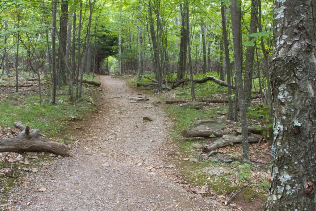
The Limberlost trail is one of the easiest hikes in Shenandoah National Park. It’s also the only ADA accessible trail in the park.
This makes it a great walk through the forest for all ages and abilities.
Pets are not allowed on the Limberlost Trail except for service animals.
The parking area for the Limberlost trail is at mile 43 in the park’s Central District. View the trail map and directions here.
Story of the Forest
- Distance: 1.8 miles
- Elevation gain: 290 feet
The first half of the Story of the Forest Trail provides an easy, kid-friendly walk in the woods. The second half of the trail takes you along a paved bike path that parallels a road.
Pets are not permitted on this trail except service animals.
The Story of the Forest trail begins down the sidewalk from Byrd Visitor Center at mile 51. View the trail map and directions here.
Snead Farm Loop
- Distance: 3.7 miles
- Elevation gain: 580 feet
If the Fox Hollow Trail sounds interesting to you but you’re looking for a longer hike, check out the nearby Snead Farm Loop.
Snead Farm Loop takes hikers through an area full of history from the land’s previous residents. Follow an access road to the Snead barn and continue around the loop to be rewarded with a valley view on your way back to the trailhead.
Pets may join you on the Snead Farm Loop if they are leashed.
Snead Farm Loop begins across from the Dickey Ridge Visitor Center in the park’s North District at mile 5.1. View the trail map and directions here.

If you found this article helpful, check out even more national park articles!
As always, enjoy the outdoors responsibly. Leave no trace on all of your adventures.